


Rasuwagadhi Bridge Collapse: Alternate Routes for Kailash Yatra After Flood
Mount Kailash, revered across Hinduism, Buddhism, Jainism, and Bon traditions, stands as one of the most sacred pilgrimage destinations on Earth.

-
 admin
admin
-
17 July, 2025
-
16 mins read
-
1087 Views
-
0 Comments
Thousands of spiritual seekers and devout followers from Nepal, India, and beyond every year undertake the sacred Kailash Mansarovar Yatra—a spiritual journey through the Himalayas to cross a spiritual circuit around this deity mountain and bathe at the spiritual banks of Lake Mansarovor. For decades, one of the most convenient of the several overland paths to Kailash from Nepal was through the Rasuwagadhi–Kerung border, a doorway that joins Kathmandu direct to Tibet's Kyirong prefecture.
However, a natural disaster occurred unexpectedly in the month of July 2025. It was a devastating flood—caused by a glacial lake burst deep in the Tibetan Himalayas—that took away the Rasuwagadhi–Kerung Friendship Bridge, leaving one of the most important land routes between Nepal and Tibet snapped. It not only stopped the border trade and transmission of energy but even put a pause to the spiritual sojourn for a large numbers of pilgrims preparing for the Kailash Mansarovor Yatra this year.
Here, we talk about the reasons of the flood, impact of the flood, current condition of the-border infrastructure, and above all, new alternative paths now possible for arriving at Kailash Mansarovar. Air, through road, or a mix of two, we'll explain now the trail that now you can still achieve your spiritual future with maximum logistical assistance and professional planning.
Let us know if you are also interested in Manaslu Circuit Trek, Tsum Valley Trek and Manaslu Base Camp Trek.
Overview
Nepal–China Friendship Gate of the Rasuwagadhi–Kerung cross-border (pre-July 2025 flood). This most vital gateway (Bhote Kosi river) connected Kathmandu to Tibet’s Mount Kailash Mansarovar, but disasterously was destroyed on 8th July 2025. Horrific debris flow (some 10 m high) scoured along the Bhote Kosi valley, washing away the international “Miteri” bridge, and nearby infrastructure. At least nine are dead and some 20 are missing, including some travellers, truck drivers. The deluge swept away a section of Nepal’s lifeline: four major hydropower stations (Rasuwagadhi, Trisuli III, Trisuli, Benighat) were disabled seriously, blacking some 230 MW (≈8%) of Nepal’s electricity infrastructure. Some 100+ container trucks, cars left unattended at the Timure Dry Port were swept off. In a word, the Rasuwagadhi disaster not only shut a vital Pilgrims route, but even the trade corridor, completely, was seriously affected.
In the flood’s aftermath, the damaged border bridge and muddy river chaos are clear to see. This disaster was not induced through monsoon rain: hydrologists record almost not a heavy precipitation existed prior to the event at the Bhote Kosi basin. Instead, satellite analysis traced, the surge back to Tibet.
Glacial lakes on the Purepu Cangbu glacier merged cumulatively to form a giant supraglacial lake in June, which overflowed abruptly downwards through the Lende River (Bhote Kosi tributarian). In other words, this seems to be a Glacial Lake Outburst Flood (GLOF). Such GLOFs are even now a relative rare event, but climate warming brings them closer: the Himalaya is “melting twice as fast as the rest of the world,” a 2018 analysis found dozens of deadly lakes on Himalayan glaciers. As more of these volatile lakes are getting warmer, researchers confirm that Nepal's high valleys are getting more vulnerable.
Why the Flood Was So Unusual
- Burst lake, not rain. Government officials initially wondered if there was heavy rain, but river level monitors revealed that there was not heavy rain that evening in Nepal nor Tibet. Tribhuvan University hydrologist Binod Pokharel observed that satellite/radar imagery revealed not enough rain, but rather, the flood “could have been caused by a GLOF”. This fits well with the high-energy debris flow and localized rain scarcity.
- Remote glacier trigger. Tracing back through Copernicus satellite images, it was discovered that the trigger source was Purepu Cangbu glacier (Tibet), where lakes combined together and drained through englacial channels towards the Lende River. That explosion spread downstream almost instantly to Nepal.
- Factor of climate change. Glaciers are retreating rapidly. The Nepali Times reports that of the 47 most dangerous lakes threatening Nepal, 25 lie on Chinese glaciers. As high lakes are growing, disaster explosions are becoming more frequent. (Notable recent examples are the 2021 Chamoli, India, and 2023 Sikkim floods from a glacial/landlide event.) While historically uncommon, authorities now consider that GLOFs are a new threat for the Himalayas.
- Geo-warnings. Surprisingly, even Nepali scientists cautioned authorities days before the event that they could anticipate deluges from rivers coming from Tibet. Yet, data-sharing gap provided that Nepal received limited prior warning. In either case, that was a record inter-state disaster, which substantiates that such cross-border floods, though occasional, are a serious threat for the people living near borders.
Effects on Bor der Security and Infrastructure
The Rasuwagadhi–Kerung (or Kyirong, Kerong) is Nepal's second significant China (after Tatopani/Kodari) trading entrance. It was opened in 2014 and newly upgraded for tourism, accommodates a major portion of vehicles, automobiles, trucks, coaches, trains, and a major portion of pilgrims. The flood “washed away a strategic bridge on Nepal’s main border crossing with China for trade, tourists and pilgrims”. In practical terms:
- Bridges, border installations lost. Nepal's 156-meter-long Miteri Friendship Bridge was swept off completely. Customs offices, lodges, sections of roads on either side completely lost. (Dozens of Nepal Police, Chinese officials were on the spot; some Chinese media reported 11 labourers missing or hurt on Tibetian side.)
- Power supply, trading losses. Four hydropower station damages (Rasuwagadhi, Trisuli-III, Trisuli, Benighat) disconnected 230 MW supply (≈8% of national generation). Freight halted: more than 100 container trucks (mainly cargo trucks of vehicles, other vehicles, and cargo) and numerous newly arriving electric vehicles were halted. Companies are afraid of shortage (particularly of Chinese goods) if the border is closed.
- Human cost. At least 9 lost lives and 20 are still unaccounted (residents, pilgrims, truck drivers) in Nepal. Chinese media reported additional 6 unaccounted for, which shows the transboundary nature of the disaster. Hundreds of residents were airlifted. This transboundary flood at Rasuwagadhi is arguably one of the most lethal transboundary floods that Nepal can recollect in recent years.
Reconstruction of the Rasuwagadhi Bridge
Nepalese authorities moved quickly to restore the route. In a special meeting on 9th of July, authorities agreed to cooperate closely with China to repair the route and re-open the connection. Main steps are:
- Interim Bailey Bridge. Prime Minister Oli directed diplomats to arrange a temporary Bailey bridge at the damaged site. In fact, the government formally requested that China construct a Bailey bridge “immediately” so cross-border traffic gets moving again. Such a mobile steel modular bridge could span the Lende Khola and facilitate convoys of vehicles carrying trade through in a matter of weeks.
- New permanent “Friendship” Bridge. Chinese engineering teams had already begun work to reconstruct the permanent bridge (originally planned in 2018). Full-scale Nepal-China Friendship Bridge will be re-constructed at Rasuwagadhi, with the help of Chinese authorities. Bridge works were targets to be completed some time near around mid-2025 prior to the disaster, but the new disaster re-ticks the clock. Reconstruction will be taken up afterwards of the immediate works of flood relief, say authorities.
- Repair of roads. Nepal will restore approach roadway from the Nepal side, as well, and requested China restore partially-damaged Tibet side roadway. Power transmission lines, including communication networks, for the region will be reinstated. Overall, authorities confirm a several-week to several-month interval before Rasuwagadhi-Kerung reopens.
In short, Rasuwagadhi is expected to reopen eventually (with a temporary bridge followed by a new permanent span), but not immediately. Meanwhile, Kailash pilgrims and traders must use alternative routes.
Other Routes of Mount Kailash
Since Rasuwagadhi is closed, we have three Nepal-based means of reaching Kailash–Mansarovar. Bold Himalaya can facilitate all of these, from flight booking, treks, cars, permissions and guides. These are the most prominent means:
- Hilsa Route (via Nepalgunj–Simikot): This is still the most direct Nepali entrance route to Tibet today. Pilgrims fly Kathmandu→Nepalgunj→Simikot, helicopter (or trek) from Simikot to the Nepal/Hilsa border. Once at Hilsa, pilgrims cross into Purang (Tibet) and drive to Mansarovar/Darchen.
- Tatopani/Kodari Route (via Kathmandu–Zhangmu): Leaving Kathmandu for Tatopani (Kodari) border–crossing via Arniko Highway, they continue via Zhangmu (Tibet) to Kailash. This ancient trade route requires Chinese and Nepali visas and is about 14+ days total.
- Lhasa Air Route: Pilgrims travel Kathmandu→Lhasa (Tibet) flight, then bus/car (via Saga–Lake Mansarovar) to Mt. Kailash. It is Tibet flight route, which is a more scenic, less physically challenging route.
All of these routes are a time, money, adventure trade-off. What follows is a more detailed description of each route.
1. Hilsa Route (Flight to Simikot + Helicopter Trek)
Route Overview: Kathmandu → Nepalgunj (flight) → Simikot (flight) → Hilsa (trek or helicopter) → Purang (Tibet) → Mansarovar → Darchen (Mt. Kailash base).
- Kathmandu to Nepalgunj: Domestic flights operate daily (approximately 45 min). Nepalgunj Airport (150 m alt.) is the point of entry
- Nepalgunj to Simikot: Charter aircraft (30–40 min) take pilgrims to Simikot (2,910 m), the district headquarters of Humla, which lies in a remote area
- Simikot to Hilsa: Pilgrims either travel via foot treks or via helicopters from Simikot. Foot trail (approximately 150–200 km) means ancient trading channels via high altitudinal mountain passes (Nara La ~5,000 m) to reach Hilsa. Porters locally traverse via this route via 7–8 days. However, most of the pilgrims conserve time and energy for themselves via helicopter hiring from Simikot to Hilsa (straight 30–40 min flight). In other words, the flight, despite the hefty price, saves the long weeklong foot trail.
- Hilsa border: Closest Nepal–Tibet cross-border is Hilsa (3,770 m). It is a short walk from the cross-border to Purang (Taklakot) on the Tibet side. Pilgrims are welcomed at Purang with vehicles (usually 4×4 land cruisers, which are reserved through touring agents).
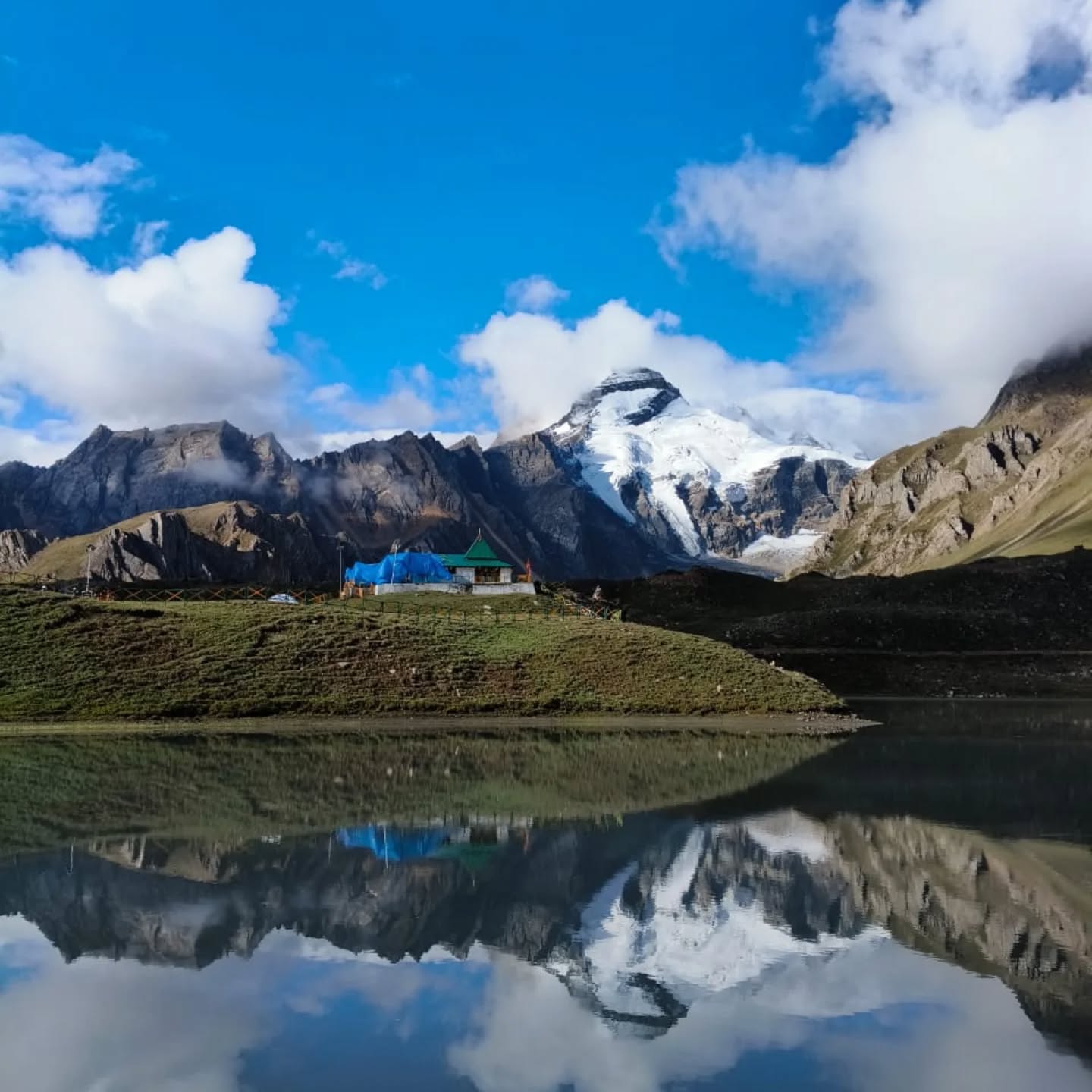
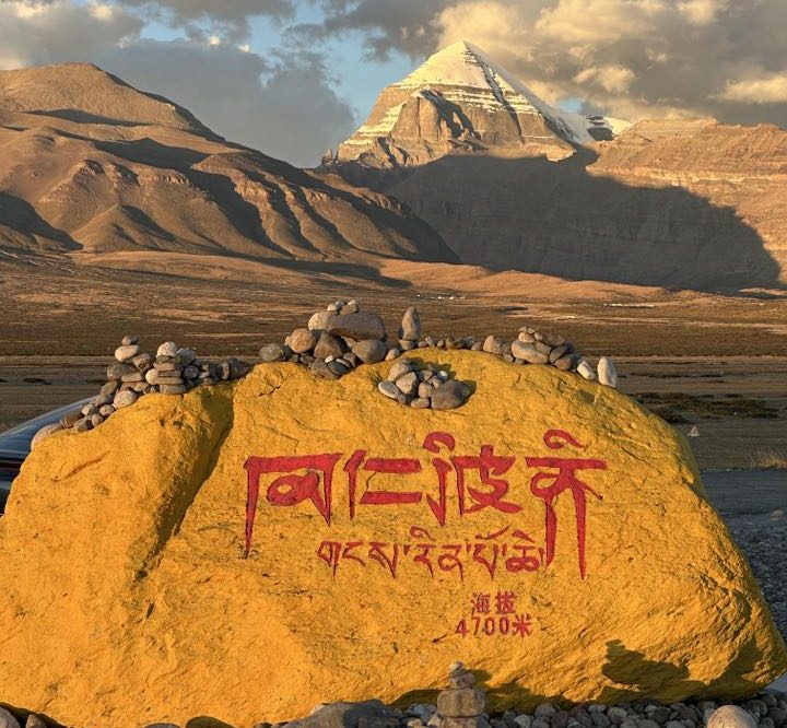
- Purang to Mansarovar: It ascends north from Purang (2,900 m) to Lake Manasarovar (4,590 m), and to Darchen (4,650 m), the classical base for parikrama of Kailash. The Kailash-Kora trek is done around Darchen.
- Length & Difficulty: Pilgrims riding the helicopter can undertake the trail for approximately 10–15 days overall. Difficulty remains steady at a moderate level via the helicopter leg; some of the high passes are traversed but fairly gentle ascents. The trail of Hilsa is shorter and less crowded compared to the overland route.
Bold Himalaya Facilities: Our agency specializes in this offbeat Hilsa journey. Kathmandu–Nepalgunj–Simikot flight bookings are arranged, helicopter transfers to Hilsa are organized, and trustworthy guides/porters are provided. All of the approval (Nepalese entry and Chinese Group Tourist Visa) are pre-booked. Guests stay at modest Humla teahouses and comfortable lodges at Purang. As one Bold Himalaya tour description notes, this package “starts from Kathmandu to Nepalgunj and Simikot by scheduled flight and flies to Hilsa by helicopter”. Visitors, now, can reach the Hilsa border via helicopter within a day or two, whereas previously, they were on a seven-day-long-difficult-treking. We also provide altitude acclimatization support along the way.
2. Tatopani (Kodari) Route: Kathmandu → Kharta Highway
Route Overview: Kathmandu → Kathmandu–Kodari (Arniko Highway) → Border crossing at Tatopani (Nepal)–Zhangmu (Tibet) → Nyalam → Saga–Mansarovar → Darchen.
- Kodari from Kathmandu: Arniko Highway goes ~140 km northeast of Kathmandu to Tatopani (new Kodari) border at 1,700 m. This takes about 5–6 hours by tourist bus or jeep (longer with traffic up mountains). Charter choppers are available (30–40 min) to Kodari border or nearby Helambu.
- Border cross: Tatopani (Nepal) is the last customs point on the Nepali side; travelers then walk across to Zhangmu (Tibet) or cross by vehicle via the Friendship Bridge. As of July 2025, exclusive clearances are given by Chinese authorities for travellers (mostly pilgrims) to cross Kodari after the suspension of Rasuwagadhi. All travellers are supposed to have group clearances and Chinese authorities pre-booked visas.
- Onward to Kailash: At Zhangmu (alt ~2,300 m), whilst approaching Tibet, the pilgrims are transported on a Chinese sightseeing bus. It goes north through Nyalam (3,750 m) and Khasa, then through the Friendship Highway (beyond Lalung La ~5,150 m) to Saga. Pilgrim route from Saga goes south for Lake Mansarovar and Darchen.
- Timing & Comments: This 12–16 day roundtrip from Kathmandu overland journey is not a trek (fully motorable), but involves long car journeys and higher altitudes (to ~5,150 m). It could be cheaper than Kodari route, which is a bit shorter. It was also historically the first overland route to Kailash via Nepal. Bold Himalaya can arrange for comfortable tourism coaches, 4×4 cars, along with professional Tibet guides for this journey.
Notable Development: In mid-July 2025, after the Rasuwagadhi bridge failure, the Chinese government granted permission for special pilgrim groups to cross at Kodari. In practice, therefore, we can re-route Nepal/India Yatra parties through Tatopani–Zhangmu as a replacement. Bold Himalaya can accommodate this: we book clients securing the right Chinese group permit (usu. locally organized in Kathmandu) and manage the border arrangements. Our tours include safe accommodations along the Arniko Highway and in Tibet (e.g. hotels at Nyalam and Saga).
3. Lhasa Air Route: Fly–Drive through Lhas
Route Overview: Kathmandu → Lhasa (flight) → Gyirong/Kerung border → Saga–Mansarovar → Darchen → Kathmandu
- Kathmandu–Lhasa Flight: Kathmandu is linked with Lhasa Gonggar Airport (3,650 m) via international flights (about 2 hours a day). It is a trans-Himalayan scenic flight that will provide a person with a clear view of Everest, Shishapangma, etc. Arriving in Lhasa provides good acclimatization at high altitude.
- Lhasa Sights: Pilgrims usually spend 1–2 days in Lhasa (3,650 m) acclimatizing and sightseeing (Potala Palace, Jokhang Temple, etc.). This section is optional but favorite for cultural interest.
- Kailash Drive: Finally, the mode of travel is via road. Usually, the bus goes northwest through Nagchu and Saga, and beyond on the Ali–Paryang route to Lake Manasarovor and Darchen (ft. of Mt. Kailash). It usually takes ~5–6 days of car/overnight camping before getting to Darchen.
- Duration & Characteristics: It can be possible to complete the whole of Lhasa-roundtrip within 12–15 days. A traditional 14-day long Kailash Yatra through Lhasa involves a Kathmandu/Lumbini/Delhi to Lhasa flight, together with a Tibet Volvo bus journey. It is a less physically demanding (no treks) route with extra days for a visit (Lhasa city, monasteric sites). It is costly compared to other two routes, due to the international flight. The route through Lhasa “allows for steady acclimatization” and involves the complete Kailash Kora.
Bold Himalaya’s Role: Our Lhasa–Kathmandu flight and Tibet visa for the tour are part of the deal. In Tibet, we offer English speakers, comfortable tourist buses. Permit, on-road hotels (e.g. Nyalam, Mansarovor, Saga), food are part of the deal. Our group sizes are reasonable so that personal attention can be given. In a combination of flight with on-road travel, exposure to culture along the way to most holiest sites, this is a deal for clients less eager for rough travel.
What About the Rasuwagadhi–Kerung Route?
The Rasuwagadhi–Kerung (Kyirong) route is the direct Kathmandu-Kailash highway through Dhunche and Syabrubesi. Until July 2025, that was the busiest Nepal route. But now that route is closed, because of the flood. Nepali officials are clear: only temporary crossing is possible now. A Bailey bridge is being installed to reestablish the connection, but a new, more enduring bridge is projected, which will be a long-time wait. Pilgrims should not rely on Rasuwagadhi being open in mid-2025. Bold Himalaya will monitor the situation closely; we will inform any clients if the road reopens (it may be late in the season). In the meantime, all Yatra bookings should use one of the three alternative routes above.
Bold Himalaya: Guiding Pilgrims through Side Routes
At Bold Himalaya, we are quite aware that these sorts of interrupptions are disorienting. Our well-informed staff already assists many of Kailash rebook through varied routes. This is the manner through which we assist:
- Route Organising & Bookings: Our organisation can reorganise your complete Kailash routing. Whether via the Hilsa–Simikot route, Kodari road, or flight to Lhasa, we’ve got the works. It includes your international/domestic flight booking, helicopter charters, ground transfers.
- Flight Coordination: We book seats on Kathmandu–Nepalgunj and Nepalgunj–Simikot routing (on availability). For tours to Lhasa, we book Kathmandu–Lhasa airlines tickets and, on demand, Lhasa city tours.
- Helicopter Service: If you pick the Hilsa route, we charter helicopters from Simikot to Hilsa. These are helicopter amphibian rescue, which are ideal for swift river crossovers direct to Tibet, whereas our porter teams can be utilized by the trekkers.
- Ground Transportation: High-height SUVs, for car rides, and sightseeing coaches are available. Drivers are familiar with Himalayan highways. Trained Tibetan guides, along with comfortable bus services, are available for the entire Tibet journey.
- Permits and Visas: For going to Kailash, we require special permissions (Group Tourist Visas) of China. We procure these visas for every route. For Hilsa Border, we also book for every Border permit of Nepal (such as Humla District permit). We book everything so that you don't have to bother for your pilgrimage.
- Accommodation & Food: All lodges or guesthouses are pre-reserved for Kathmandu, for intermediate nights (e.g. Nepalgunj, Simikot, Lhasa, Saga), and for lake camps. Food is supplied from tea houses or lodges on route.
- Guides and Assistance: Our guides are competent in Nepali, English, and (where appropriate) Mandarin. They are fully cognizant of the spiritual and cultural character of the journey. Oxygen packs and medical kits are provided for eventualities. Tourist assistance vehicles are provided for trekking parties.
In summary, Bold Himalaya provides customized treks to Kailash Mansarovar with all possible Nepali routes. Tours are flexible and always safe: i.e., if we anticipate that we are going to wait at some given border, we can add advance vehicles or prescribe small timetabling corrections. Our mission is a hiccup-free trip: “all the way from Kathmandu to Mansarovar and back,” even when conditions change.
Conclusion
This summer, devotee pilgrims can still reach Mt. Kailash Mansarovar via a different route, but through a veteran company like Bold Himalaya. The Hilsa route is now the most direct land approach from Nepal, while Kodari and Lhasa flights provide solid alternatives.
Bold Himalaya is fully able to re-direct tours through these routes, therefore your yatra continues. We monitor conditions daily; as soon as Rasuwagadhi reopens, we will resume our normal packages there. Until then, rest assured that you have options. The Himalaya’s spiritual journey still awaits—our team is ready to guide you across whichever route you choose.
Comments (0)
Write a comment- Overview
- Why the Flood Was So Unusual
- Effects on Bor der Security and Infrastructure
- Reconstruction of the Rasuwagadhi Bridge
- Other Routes of Mount Kailash
- 1. Hilsa Route (Flight to Simikot + Helicopter Trek)
- 2. Tatopani (Kodari) Route: Kathmandu → Kharta Highway
- 3. Lhasa Air Route: Fly–Drive through Lhas
- What About the Rasuwagadhi–Kerung Route?
- Bold Himalaya: Guiding Pilgrims through Side Routes
Read the latest Blogs & Insights
Explore our collection of articles and insights to gain in-depth travel knowledge, expert advice, and stay updated on the latest trends and tips.
Adi Kailash Yatra and Trek 2026 Essentials

Best Photography Spots on Popular Treks
No comments yet.