


The Himalayas: The Majestic Crown of the Earth
-
 admin
admin -
29 October, 2024
-
23 mins read
-
4352 Views
-
0 Comments
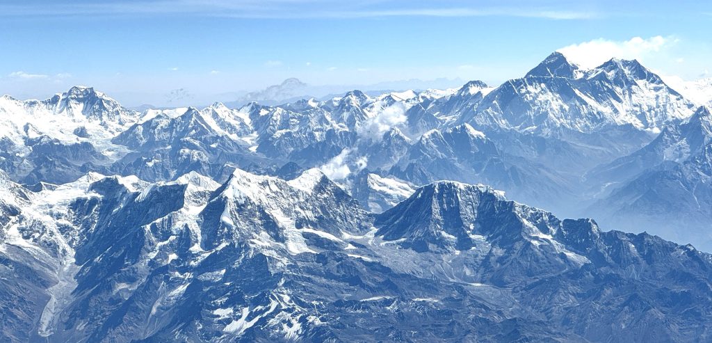
The Himalayas, or the “Roof of the World,” is the world’s highest and most spectacular mountain chain. It runs from Nepal to India, Bhutan, China, and Pakistan as an inspiring chain of mountains that physically divides the Indian subcontinent from the Tibetan Plateau. It runs an awe-inspiring 2,400 kilometres in length and features some of the world’s highest peaks, like 8,848-meter-tall Mount Everest and 8,611-meter-tall K2. The mountains are crossed by thousands of trekkers and climbers, besides regulating climatic conditions and supporting life through their vast river systems.
But far greater than their towering elevation, the Himalayas also hold gigantic cultural, spiritual, and environmental importance. They are home to some of the world’s oldest cultures, revered by Hinduism and Buddhism, and filled with myth, with tales of the elusive Yeti adding to their enigma. They are also a haven of diversity where shy animals like the snow leopard and the red panda have their habitats in forests.
The Himalayas are moulded by dynamic powers of nature, ranging from glacial lakes to the mighty valleys, and are constantly remoulded by tectonic forces. Their framework, geography, climate, glaciers, rivers, flora and fauna, and cultural significance are well covered in the blog.
Countries Covered by the Himalayas
The Majestic Himalayas weave across five countries: Nepal, China, India, Bhutan, and Pakistan to form breathtaking mountain systems on Earth. In India, they cradle famous hill stations of Simla and Darjeeling, wherein Nepal, there stands the world’s highest mountain, Mount Everest, symbolizing spirituality and its nature. Bhutan has been blessed with the beauty of the Himalayas, where snow-crowned peaks mingle with ancient monasteries. The Tibet region in China holds vast expanses of plateaus and sacred mountains, whereas in Northern Pakistan, there are the Himalayas that attract trekkers and explorers from all over the world. These nation shares the inspiring beauty and cultural richness of the Majestic Himalayas, truly making it the Crown of the World.
Nepal: The Heart of the Himalayas
In the very core of the mystical Himalayas, Nepal stands tall as the “Crown of the Earth”. It is the land where there are different majestic Himalayas that whisper a legend, and every trail leads to a spiritual rise.
Home of the world’s highest peak, Mount Everest, Nepal is more than a destination. It has the eight highest peaks in the world among the fourteen highest peaks. From the dynamic streets of the Kathmandu valley to the silent majesty of the Annapurna Range, this nation represents the unity of nature and the divine.
In Nepal, the Himalayas are not only distant, gigantic, but living guardians, shaping the life’s rhythms and encouraging the countless souls to seek peace among their timeless greatness.
India: Spiritual and Scenic Diversity
India is a place where spirituality meets breathtaking natural beauty in majestic ways. From the majestic Himalayas to the Golden Desert of Rajasthan and the peaceful backwaters of Kerala, every region of the country represents the incredible diversity of India.
Himalayas like Mount Kanchenjunga and Nanda Devi are the heart of India, which attracts trekkers, explorers, and spiritual seekers from around the world. The Northern range of the Himalayas in India recalls a sense of peace and adventure, whereas the ancient temples are full of colourful festivals, ingrained culture and tradition, showing the spiritual soul of India. From meditation in the mountains to culture in the cities, India gives some unforgettable moments of natural beauty and divine energies.
Either the spirituality of Rishikesh or the snowy silence of Ladakh in the Himalayas, India, invites the journey that catches both eye and soul. Apart from the Himalayas, India’s scenic diversity unfolds in endless ways.
Bhutan: The Land of Gross National Happiness
Bhutan is a country where well-being and harmony take priority over material wealth. That’s why this country is also known as the Land of Gross National Happiness. It is a serene kingdom with towering snow-capped peaks and emerald green valleys of the Himalayas, which create a majestic background to the country that aims for success in the well-being of the people. It is rich in cultural heritage that manifests in vibrant festivals, ancient monasteries, and painted dzongs, all testifying to the centuries-long tradition.
In Bhutan, life moves in time with the pace of mountains, rivers, and forests, which is a place of unique Himalayan nature and culture where every moment seems to be infused with the spirit of peacefulness and the simple way of living.
Pakistan: Home of K2 and Karakoram Range
Pakistan is a country where some of the majestic Himalayas are located. It is the home of K2 and the Karakoram range, where the mighty Himalayas extend their magnificent presence beyond borders. Towering peaks, deep valleys, and rivers of ice are all part of the landscape, which reflects the nature of the Himalayas in all their diversity.
In Pakistan, the Himalayas Range covers the northern region of Gilgit Baltistan and Azad Kashmir, offering landscapes that were painted by the divine hand of nature. The mixture of Himalayan culture with natural splendor makes Pakistan, not only for mountaineers, but also a living harmony with nature. Towering peaks such as Nanga Parbat, which is also called a “Killer Mountain,” rise into the clouds, standing as the tallest peak in the world.
Not only is the breathtaking scenery, but this country is also rich in culture and traditions, where the local communities preserve their dynamic heritage and age-old customs.
China and Tibet: Mystical Highlands
China and Tibet are also known as the Mystical Highlands, which showcases a gateway to the Majestic Himalayas with a region of beautiful peaks combined with the stunning valleys that present beautiful landscapes and rise above the skyline.
These areas form a part of the Himalayan Mountains that run through the Indian subcontinent’s northern border and offer travelers a journey through nature and devotion. Tibet’s highland and sacred places provide visitors following a Himalayan travel guide an engrossing experience of religion, culture, and stunning landscapes. Trekking routes, monasteries, and observation sites allow one to explore the Himalayas, making tourism a memorable experience.
A well-planned Himalayas travel guide would help you to explore the Himalayas through trekking trails, ancient pilgrimage routes, and scenic viewpoints that reflect its beauty. Himalayas tourism in Tibet is not only about landscapes but a rich cultural tapestry, monasteries, and age-old traditions thriving atop the Roof of the World Himalayas.
Formation and Geography of the Himalayas
1. The Himalayas: Tectonics’ masterpiece
Two enormous parts of the Earth’s crust were pushed against each other to build the Himalayas. The Indian Plate was moving north at a glacial pace of approximately 15 cm/yr some 50 million years ago and collided with the Eurasian Plate. The intense pressure flexed and uplifted rocks to build the gigantic mountains that we now see. It is still ongoing, and therefore, the Himalayas are rising by some 5 mm every year. We know that they were underwater before that because sea creature fossils were discovered even on top of Mount Everest!
2. Geologic Structure and Composition
They possess three huge divisions of the Himalayas:
a. The Great Himalayas (Himadri)
- The highest central belt with the highest peaks in the world, like Everest and Annapurna
- Made up of extremely old crystalline rocks, metamorphic rocks, and granite
- Covered with glaciers, grand gorges, and broken slopes that are impassable even to the best climbers
b. The Lesser Himalayas (Himachal)
- Located between the Greater and Outer Himalayas
- Marked by wooded slopes, grassy valleys, and moderate heights (2,000–5,000 meters)
- Scattered with varied vegetation and fauna, including dense oak, rhododendron, and pine woods
c. The Outer Himalayas (Siwalik Hills)
- The most southernly and youngest of the ranges, formed of sedimentary rocks
- Constructed by deposits and denudation of the higher ranges
- Rising gradients, tiny streams, and vegetation
The Stunning Physical Structure of the Himalayas
1. Enormous Elevations and Scenic Vistas
The Himalayas are highly physical in nature with mammoth heights, mammoth valleys, mammoth ice glaciers, and rock cliffs. The central range is crescent in nature and has a sudden uplift over the rest of the lowlands. All these various heights create various zones, and each one of these zones has a different set of flora, fauna, and climate.
2. The Four Main Mountain Belts
The Himalayas can be divided into four parallel belts, and each of these belongs to another category:
- Outer Himalayas (Siwalik Range) – The most southerly and youngest component, comprising rolling foothills and hills
- Lesser Himalayas – Hill and forest belt with gigantic valleys and dense flora and fauna in the form of temperature and subtropics
- Greater Himalayas – the zone where the tallest peaks are, i.e., Everest, K2, and Kanchenjunga, with permanent snow and glaciers
- Tethys Himalayas (Tibetan Himalayas) – northernmost, an upland fragment of cold country and desert-type.
3. West-to-East Regional Divisions
Apart from these belts, the Himalayas have also been divided into three west-to-east regions:
- Western Himalayas: Between western Nepal and Pakistan, with such mountains as Nanga Parbat
- Central Himalayas: Passing through Nepal, i.e., Everest, Annapurna, and other giant peaks
- Eastern Himalayas: Passing through Bhutan and India, and spanning dense forests and wildlife
All these unique characteristics make the Himalayas an interesting place for geologists, explorers, and nature enthusiasts alike.
Climate and Weather of the Himalayas
A Zone of Highly Diverse Weather
The Himalayas have a unique diversity of weather since they cover a wide range of altitudes and are distributed over a very wide area. You experience all kinds of weather, from tropical at the lower end to very cold at the higher end.
The Role of the Himalayas in Climate Regulation
The Himalayas also have the effect of shaping weather patterns in South Asia and Central Asia. The mountains:
- Keep cold winds from the north out of India; Indian winters are not cold due to this
- Push rain clouds to release their burden, locally watering fields and rivers
- Help create the Central Asian desert, the Taklamakan and Gobi, for instance

Seasonal Changes
The Himalayas experience huge fluctuations in weather over the year:
- Summer (May-June): Hot at the bottom, cold at the top
- Monsoon (July-September): Rainfall over the southern slopes for most of the day, landslips, and flood-prone areas
- Autumn (October-November): Good weather, pleasant, ideal for mountaineering and trekking
- Winter (December-February): Extremely cold with snowfall and ice
- Spring (March-April): Wild flowers, good weather, and melting snow
Glaciers, Lakes, and Rivers in the Himalayas
The Lifeline of South Asia
The Himalayas support millions of human habitats and hold the largest reservoirs apart from the polar ice cover. They support the greatest rivers that provide South Asia with wildlife, hydroelectricity, and agriculture.
1. Major Glaciers
Himalayan glaciers provide the major rivers and constitute the freshwater reservoir. Some of them are:
- Siachen Glacier (India-Pakistan border): Longest Himalayan glacier stretching 76 km
- Gangotri Glacier, India: Birthplace of the sacred River Ganges
- Baltoro Glacier (Pakistan): Massive glacier close to K2 in the Karakoram Range
- Ngozumpa Glacier (Nepal): Largest Nepalese glacier, supplying the Dudh Koshi River
They are shrinking because of global warming, jeopardizing the source of water for millions of human lives.
2. High-Altitude Lakes
The Himalayas also contain some beautiful high-altitude lakes, most of which are ecological and religious pearls:
- Pangong Lake (India-China): Seasonal color-changing Salt lake
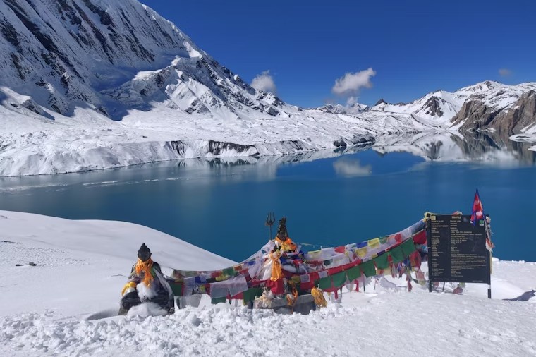
- Tilicho Lake (Nepal): World’s highest lake at 4,919m
- Gurudongmar Lake (India): Sacred lake of Sikkim held sacred by Buddhists and Sikhs
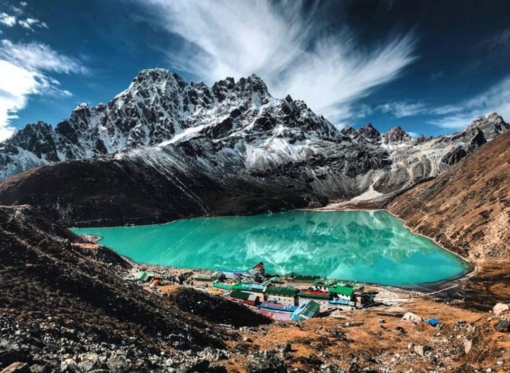
- Rara Lake (Nepal): Nepal’s largest freshwater lake with virgin forests.
They are sanctuaries to migratory birds and are also useful to the residents.
3. The Lifeline Rivers of the Himalayas
The Himalayas are the source of mighty river systems, which are lifelines to the entire Asian continent:
- The Indus River: It originates in Tibet and enters Pakistan, where it is helpful for farming
- The Ganges River: Holy river of the Hindus, and it originates from the Gangotri Glacier and sustains millions of Indians
- The Brahmaputra River: A huge river that starts from Tibet and extends as far as India and Bangladesh, and is renowned for its floods
- The Yangtze and Mekong Rivers: Both their origins are in the Tibetan Plateau and isolate China and Southeast Asia
As the Himalayan glaciers melt, even the rivers are threatened, disturbing the water table and climatic equilibrium of the region.
Flora and Fauna of the Himalayas
Diversification of Himalayan Plants
- Vegetation Zones Based on Altitude: The Himalayas are famous for the very steep gradient of vegetation with respect to altitude, geography, and climate. Tropical, subtropical, temperate, and alpine are a few of the most commonly bracketed categories. You do have middle hill and lower east tropical rainforests, but at higher elevations, alpine and temperate flora are predominant. Altitude determines what will thrive where because some flora prefer to bloom in some types of conditions. The Himalayas open up their closed forests to open alpine meadows to scientists and nature enthusiasts from around the world.
- Common and Endemic Plant Species: The Himalayas have an endemic flora of Pine, Oak, Fir, Birch, Rhododendron, Juniper, and Deodar. The Western Himalayas have Deodar cedar cultivation. Himalayan Blue Poppy and the Brahma Kamal, which are the endemic flowering plants, are found in the upper areas and make the region distinct. The Eastern Himalayas are thickly inhabited by over 4,000 flowering plants and over 20 palms. Not only do they support the environment, but they are also of priceless value to the individuals culturally, medicinally, and ritually.
- Climate and Topography-Their Role in Determining Vegetation: Himalayan flora is controlled to a great extent by topography, climate, and altitude. The humid eastern Himalayas have denser forest cover, and the arid western areas have open vegetation. Hill slopes, valleys of rivers, and plateaus in the transitional zone create small climates for the survival of diverse vegetation. Sun, wind, and soil also control what occurs where, and the Himalayas are among the most diversified mountains in the world.
Diverse Wildlife of the Himalayas
- Mammals- Adaptation to Extreme Conditions: The Himalayas are home to numerous mammals, including snow leopards, musk deer, blue sheep, tahr, wild boars, tigers, elephants, and foxes. These animals all have special features to live in the harsh Himalayan environment. Snow leopards have thick fur and wide paws to tread through snow, and Himalayan brown bears hibernate during winter. Wild yaks at high altitudes have enormous lungs to compensate for the low oxygen content. They help them survive in severe mountainous terrains.
- Rare and Endangered Species: Red pandas, Himalayan black bears, and Tibetan antelopes are a few of the endangered Himalayan species. They are protected from hunting and habitat loss. National parks like India’s Nanda Devi Biosphere Reserve and Nepal’s Sagarmatha National Park are yielding fruit. These are also not immune to the effects of global warming, apart from settlements, and thus, the preservation cannot be ignored.
- Diversity of Birds and Insects: The Himalayas are a paradise for birdwatchers with a dense tick list of over 500 species of birds. Blue magpie, black-rumped magpie, racket-tailed drongo, chough, whistling thrush, and Himalayan monal (Nepal’s national bird) love the place the most. It also has butterflies, beetles, and spiders, the majority of which are Himalayan endemics. These birds and insects are all ecologically well-adapted cast members in pest roles, seed dispersal, and pollination.
Cultural Diversity and Natural Resources of the Himalayas
Cultural Diversity of the Himalayas
- Ethnic Diversity and Religious Impact: The Himalayas are made up of many different ethnic groups and their own religion, language, and culture. Nature worship, Hinduism, Buddhism, Islam, etc., are prevalent religions. The mountains are very religious and pious, and Pashupatinath Temple and Nepal’s Muktinath are excellent Hindu temples. Muktinath is sacred in Buddhism and Jainism, and Ashtapad Mt. is sacred in Jainism. The religion followed there is Buddhism, and monasteries like Paro Taktsang in Bhutan are excellent religious places.
- Language, Architecture, and Traditional Ways: The Himalayas are ethnically varied, and over 40 languages are used in the regions. The buildings are made from materials such as wood, mud, and stone to cover the hilly terrain. Handlooms, woodcarvings, and metalwork crafts tell stories of the thriving craftsmanship of the Himalayan people. Cultural practices, dances, and rituals tell stories of thriving traditions nurtured over centuries.
Himalayan Medicinal Resources
- Indigenous Healing and Traditional Herbal Medicine: The Himalayas have medicinal herbs that are applied in local, Ayurvedic, and Tibetan medicine. A fifth of the plant flora is medicinally utilized, treating respiratory to gastrointestinal illnesses. Certain herbs like Yarsagumba (Cordyceps sinensis) are irreplaceable, being natural immunity boosters and aphrodisiacs. Local physicians and monks passed down their knowledge generation after generation, treating common and uncommon illnesses with herbs.
- Contribution towards the Global Pharmaceutical Industry: The Himalayan medicinal plants are in demand primarily across the globe. Rauvolfia serpentina treats blood pressure, and Swertia chirata liver conditions, and these are shipped abroad for world medical studies and medicine manufacturing. The resources are depleted as they are over-exploited and illegally exploited, and hence, the need for sustainability and conservation is the demand of the hour.
Economic Contributions of the Himalayas
- Mineral and Natural Resource Wealth: The Himalayas hold mineral wealth in gold, silver, copper, and zinc. The minerals occur in over 100 locations, supporting local mining economies. Coal and oil potential and massive deposits also occur regionally in Kashmir. The minerals are an essential component of regional economies and world trade. Apart from providing water, the Himalayas also function as a natural regulator of climate. They block cold winds from the centre of Asia, helping to guide the seasonal monsoon rains for farming. The glaciers and frozen highlands store massive volumes of freshwater, which gradually melt during the year to maintain river flow.
- Ecologically, the region is a biodiversity because it has rare and endangered species like the snow leopard, red panda, Himalayan Black Bear, and Himalayan monal. It’s a vast forest that absorbs carbon dioxide, making the Himalayas a vital defense against global warming. The Himalayas are not just mountains but guardians of the world. And it plays a vital role in the environmental balance and supports millions of lives.
- Tourism and Agriculture as Pillars of Economic Growth: Tourism is a crucial part of the economy of the Himalayas due to the fact that it entices climbers, pilgrims, and trekkers. The Annapurna Circuit and Everest Base Camp Trek are generating wonderful revenues for the locals. Subsistence economy continues to be sustained through agriculture, with the use of terraced agriculture leading to the cultivation of crops such as potatoes, barley, and rice. Organic agriculture and ecotourism are followed to a greater degree in an effort to promote overall economic growth and natural resource conservation.
Trekking and Adventure Activities in the Himalayas
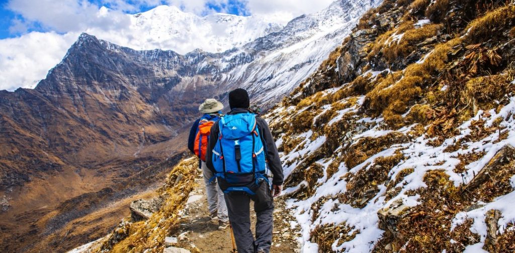
1. Trekking Trails
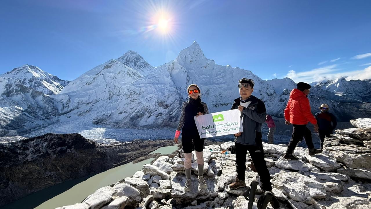
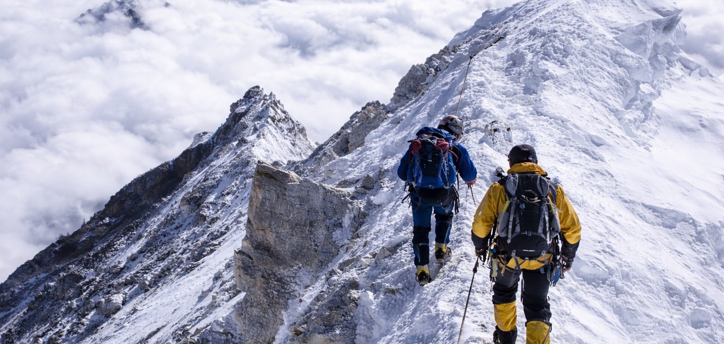
- Everest Base Camp Trek: The Everest Base Camp Trek can support a thousand trekkers annually. It is located within Sagarmatha National Park, where you have Mount Everest (8,848.86m) and several other mountains, including Lhotse and Ama Dablam. The journey is from Sherpa villages, monasteries, and forests to finally reaching Everest Base Camp at 5,364m. They all climb Kala Patthar (5,545m) for the finest view of Everest. Trekkings will usually be 12-14 days, and you would be in fairly good condition.
- Annapurna Circuit Trek: Annapurna Circuit is an early trek with varied scenery from jungle to high desert. It winds and crosses Thorong La Pass at 5,416m, one of the highest trekking passes in the world. You will see a glimpse of some massive mountains and villages during the Marshyangdi and Kali Gandaki valleys trek. You will have an opportunity to see the culture of the Mustang districts and the Tibetan people. It takes 14-18 days and is best for veterans as well as for beginners.
- Langtang Valley Trek: The Langtang Valley trek is for time-conscious travelers. Easy access to Kathmandu, it provides a moderate mountain view of Langtang Lirung and Ganesh Himal. You will be trekking through rhododendron forest, yak grazing pasture, and up to the Kyanjin Gompa monastery (3,870m). A day trek to the summit of Kyanjin Ri (4,773m) is filled with panoramic views of the mountains. Less-trodden 7-9 day equally-rewarding trek.
2. Other Himalayan Adventures
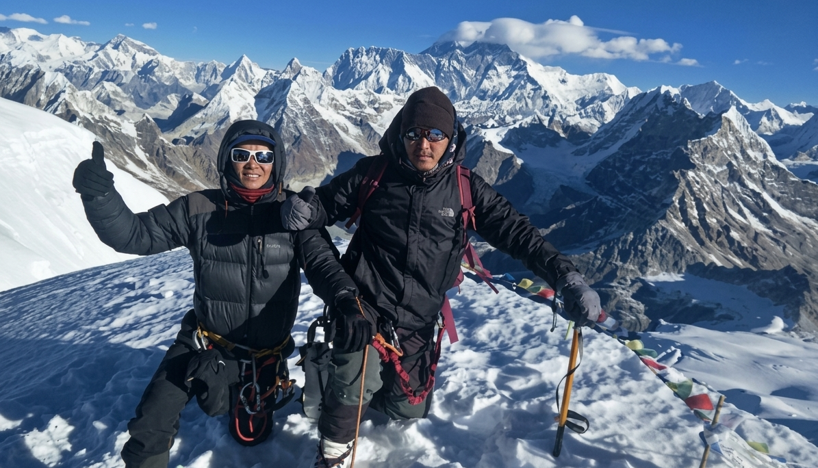
- Himalayan mountaineering in Nepal: Nepal has 8 of the world’s 14 highest mountains and is therefore a heaven for mountaineers. Mountaineers are in Nepal to conquer giants like Everest, Annapurna, Manaslu, and Makalu. Weeks of acclimatization at lower altitudes and technical skill are needed. For example, to ascend Everest, one must be trained in different camps before the actual climb.
- Skiing and Snowboarding: New, Nepali origin. Langtang, Manang, and Annapurna districts offer skier’s skiing, primarily winter skiing. Powder snow backcountry skiing at high altitude is simply heavenly. Professional heli-skiing, too, is being organized in the Kalinchowk and Mustangs, already popular winter sports holiday spots. Even professional heli-skiing is being organized in the Everest area. New to Nepali skiers, though, it draws the winter sports tourists.
- Hard paragliding in the Himalayas: Paragliding provides a bird’s-eye view of the Himalayas. Pokhara is the best spot to take off from Sarangkot Hill (1,600m) and fly over Phewa Lake with the Annapurna range in the backdrop. Bandipur and Godavari are equally good as a second option. Tandem flights by experienced pilots are the norm for most of the travelers. Flight would be 20-40 minutes, depending on the weather. Nepal’s paragliding industry is growing at a very rapid pace.
Spiritual & Religious Significance of the Himalayas
Sacred Sites in the Himalayas
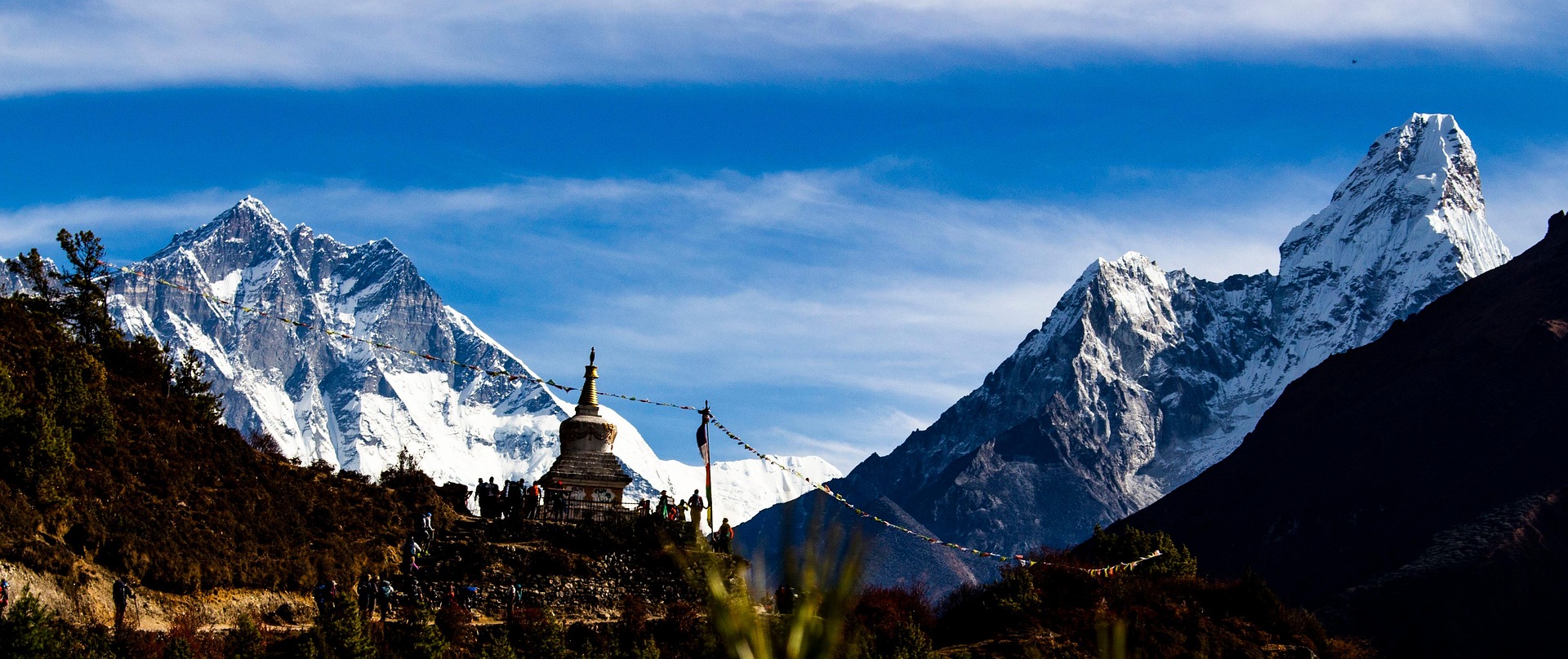
- Muktinath Temple: Muktinath at 3,800m is located in the Mustang district and is sacred to both Hindus and Buddhists. It has been considered by the Hindus as the origin from where Lord Vishnu attained liberation, and by the Buddhists as one that is parallel to Guru Rinpoche. It is a 108-stone water-gushing temple and a natural, ever-burning flame. Pilgrims take baths in the ice-cold water to wash away sins. Muktinath is a trek in itself, and one has to trek or take bumpy jeeps.
- Tengboche Monastery: Tengboche Monastery (3,867m) is the largest Buddhist monastery in the Khumbu valley and offers a wonderful view of Everest and Ama Dablam. It’s a sacred place for Sherpas, and where the mask dance ceremony, annually known as the Mani Rimdu festival, is performed. The trekkers on trek usually camp overnight in its peaceful surroundings and observe Buddhist rituals. It’s built to promote more Sherpa Buddhist culture.
Himalayas in Hindu & Buddhist culture
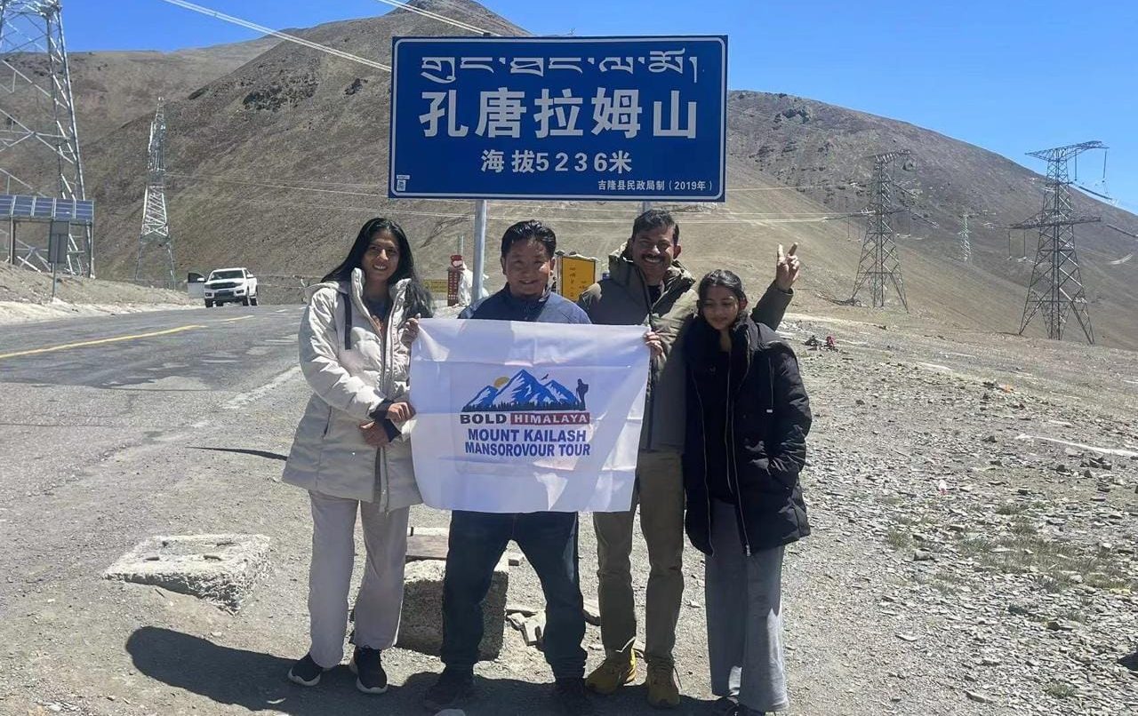
The Himalayas are astronomically humongous in significance to Hindu and Buddhist culture. The Himalayas are the dwelling of Lord Shiva and the spiritual home of Mount Kailash in Hindu mythology. Nearly all Hindu mythology describes seers who would visit there to meditate. The site is associated with Buddha and Guru Rinpoche’s teachings during Buddhist times. The mani walls, the prayer flags, and the monasteries are evidence of the religious significance of the mountain. Spiritualists from around the globe come to gain spiritual knowledge.
Let us know if you are also interested in Manaslu Circuit Trek, Tsum Valley Trek, and Manaslu Base Camp Trek.
Himalayan Challenges and Conservation Measures
1. Climate Change in the Himalayas
The Himalayas are threatened by the advent of global warming. It is glaciating and warming the mountains at a fast pace, which is leading to glacial lake floods on the rise. Farm and wildlife, and water resources are at risk because of global warming. The pattern of snowfall becomes random, erasing neighboring civilizations on the basis of snow melting. Global warming will cause the extinction of Nepal’s permanent glaciers on a massive scale, destroying big rivers like the Ganges and Indus draining out of the Himalayas.
2. Conservation of the Himalayas
Efforts to address these challenges, Himalaya biodiversity is preserved by a series of conservation efforts. Endangered species, including the red panda and snow leopard, are protected by Sagarmatha National Park, Annapurna Conservation Area, and Langtang National Park. Afforestation schemes are working to regain ground lost, while ecotourism encourages environmental tourism. Other agencies provide sustained support for sustainable trekking and waste reduction in the mountains. All these activities are of paramount significance in an effort to preserve Nepal’s mountain system for generations to come.
3. Human Activities and Pollution
Human activities and pollution in the Himalayan region have become very serious as they affect both the environment and local communities. Some of the reasons are:
- Tourism and Trekking: The growing popularity of trekkers and pilgrims in the Himalayas has led to increased waste generation. Most of the plastic bottles, food wrappers, and other non-biodegradable trash are thrown which pollutes the rivers, forest and glacial areas.
- Deforestation and Agriculture: Increasing demand for timber, fuelwood, and agricultural land has led to deforestation in many Himalayan valleys, which affects the forest. This not only affects biodiversity but also increases sediment in rivers, contributing to water pollution and disturbing natural water flow.
- Tourism pressure on Sacred Sites: Different places like Mount Everest, Mount Annapurna, Kedarnath, Badrinath, and other tourism places experience massive tourist inflow, which not only generates waste but also increases pollution from transportation like helicopters, vehicle and construction of supporting infrastructure.
FAQs about the Himalayas
1. Where is Himalaya located in which state?
Himalaya is a range of the long Himalayas containing the world’s highest mountains. It is a bunch of mountains that spread from Pakistan to Bhutan and covers five countries: Pakistan, India, Nepal, China, and Bhutan.
2. How long is Himalaya?
The Himalayas are the highest mountain range covering approximately 2,400 kilometers (1,500 miles) from east to west. It covers high mountains to small Peaks in hundreds.
3. Why are the Himlayas important to the world?
The Great Himalayas are called the Water Towers of Asia. They provide some of the world’s greatest rivers, including the Ganges, Brahmaputra, and Indus, with fresh water for around 15000 million people. These rivers irrigate the fertile valleys and plains, hydroelectricity projects, and maintain agricultural productivity throughout South and Southeast Asia.
4. What is the highest mountain in the Himalayas?
The highest mountain in the Himalayas is Mount Everest, which stands at 8,848.86 meters (29,031.7 ft) above sea level.
5. How many of the world’s highest peaks are in the Himalayas?
The Himalayas are home to 10 of the world’s 14 mountains higher than 8,000 meters, including K2, Kanchenjunga, and Lhotse.
6. Can people trek in the Himalayas?
Yes, the Himalayas are one of the world’s most famous trekking destinations, especially in Nepal. Popular trekking routes include the Everest Base Camp Trek and the Annapurna Circuit.
7. What is the best time to visit the Himalayas?
The best seasons to visit the Himalayas are spring (March–May) and autumn (September–November) when the weather is stable, and the mountain views are clear.
8. Are the Himalayas still growing?
Yes, the Himalayas are still rising slowly due to the ongoing collision between the Indian and Eurasian tectonic plates.
Comments (0)
Write a comment- Countries Covered by the Himalayas
- Formation and Geography of the Himalayas
- The Stunning Physical Structure of the Himalayas
- Climate and Weather of the Himalayas
- Glaciers, Lakes, and Rivers in the Himalayas
- The Lifeline of South Asia
- Flora and Fauna of the Himalayas
- Cultural Diversity and Natural Resources of the Himalayas
- Trekking and Adventure Activities in the Himalayas
- Spiritual & Religious Significance of the Himalayas
- Himalayan Challenges and Conservation Measures
- FAQs about the Himalayas
- 1. Where is Himalaya located in which state?
- 2. How long is Himalaya?
- 3. Why are the Himlayas important to the world?
- 4. What is the highest mountain in the Himalayas?
- 5. How many of the world’s highest peaks are in the Himalayas?
- 6. Can people trek in the Himalayas?
- 7. What is the best time to visit the Himalayas?
- 8. Are the Himalayas still growing?
Read the latest Blogs & Insights
Explore our collection of articles and insights to gain in-depth travel knowledge, expert advice, and stay updated on the latest trends and tips.
View All Articles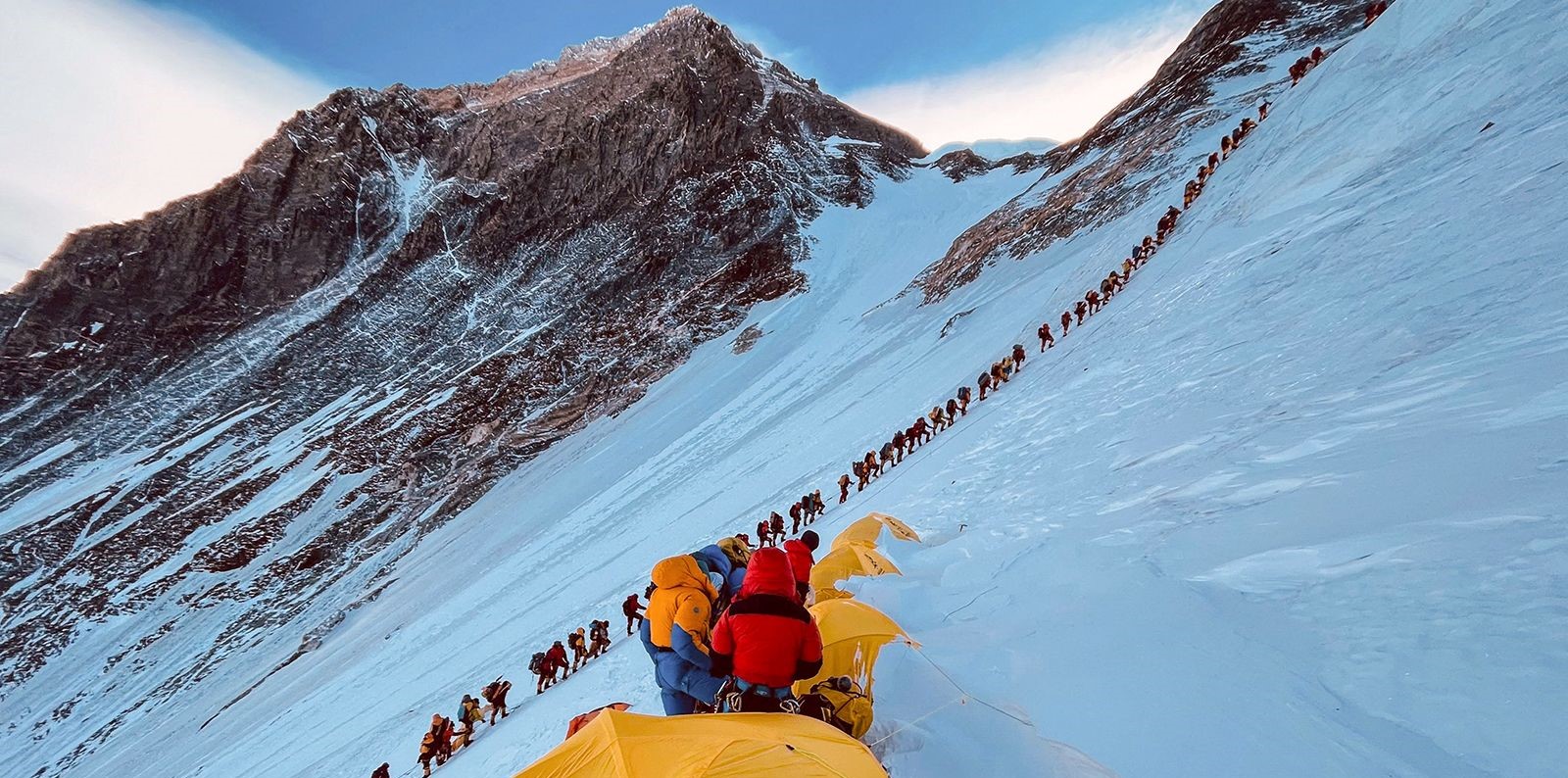

No comments yet.