


How High is Mount Everest? The Official Height and Measurement History
Most Nepalese people say 8,848 meters when asked about Mount Everest’s height, while younger guides reference 8,848.86 meters, the official 2020 measurement. Some Chinese sources mention 8,844.43 meters, reflecting earlier surveys. That was China’s measurement before the 2020 agreement. Everyone’s right, depending on which survey you trust and whether you measure rock or snow. The […]
-
 Bold Himalaya
-
4 November, 2025
-
15 mins read
-
417 Views
-
0 Comments
Most Nepalese people say 8,848 meters when asked about Mount Everest's height, while younger guides reference 8,848.86 meters, the official 2020 measurement. Some Chinese sources mention 8,844.43 meters, reflecting earlier surveys. That was China's measurement before the 2020 agreement. Everyone's right, depending on which survey you trust and whether you measure rock or snow.
The Mountain That Changes Height
Mount Everest is known by different names across cultures, each reflecting local history and belief. Understanding these names offers insight into the mountain’s cultural importance for Nepal and Tibet.
Names Across Cultures
Mount Everest straddles and Tibet's border. The summit belongs to both countries, which explains why measuring it became political.
- In Nepal, Mount Everest is called Sagarmatha, meaning "forehead in the sky."
- Tibetans call it Chomolungma, roughly translating as "goddess mother of the world."
- The English name comes from Sir George Everest, a British surveyor who ironically never saw the mountain and didn't want it named after him.
How Everest Formed
Everest exists because, about fifty million years ago, India was an island continent drifting north. When it collided with Asia, neither tectonic plate could slide beneath the other. Instead, the land crumpled upward, creating the Himalayas.
- The Himalayas are still rising, with Everest growing about 4 millimeters per year due to ongoing tectonic collision.
- This means the height isn’t fixed. It changes:
- Slowly through tectonic uplift
- Suddenly during earthquakes
Why Mount Everest's Height Has Been Controversial
The height of Mount Everest has been debated for decades due to differences in Everest measurements by Nepal, China, and international surveys.
Different Measurements
Mount Everest’s height is not as simple as a single number. Most Nepalese still cite 8,848 meters, the traditional figure taught for decades. Younger guides often reference 8,848.86 meters, which comes from the 2020 official joint measurement by Nepal and China. Meanwhile, some Chinese sources still mention 8,844.43 meters, the number recorded in China before the 2020 agreement.
All of these measurements are technically correct—it depends on which survey you trust and whether you measure rock height or snow-and-ice summit height.
Rock vs. Snow Debate
The debate over Mount Everest's height isn’t just political—it also involves whether to measure rock alone or include the snow and ice at the summit.
- Rock height stays mostly constant, except for changes caused by earthquakes.
- Snow height varies seasonally and annually depending on monsoon patterns, wind, and accumulation.
Nepal includes snow in its measurements, while China traditionally measured only the underlying rock. This difference has contributed to long-standing confusion and debates among scientists, climbers, and mapmakers.
How British Surveyors First Measured It
The first official measurements of Everest were made during the Great Trigonometrical Survey of India, which began in 1830. British surveyors aimed to systematically map the Indian subcontinent, including its tallest mountains, using the best technology of the time. Their work laid the foundation for understanding Mount Everest’s height long before anyone could set foot on the summit.
The Great Trigonometrical Survey of India
The Great Trigonometrical Survey of India started in 1830. British colonial administrators wanted to map the entire subcontinent systematically. Surveyors worked their way north from coastal India, measuring mountains, valleys, and rivers.
By 1852, they'd identified Peak XV (original designation before anyone named it Everest) as probably the world's tallest peak. They calculated 29,002 feet from observation stations over 150 kilometers away.
How They Measured It
The survey team never climbed Everest. Instead, they used:
- Theodolites to measure angles from distant points
- Triangulation to calculate the summit’s position and height
Their calculations accounted for:
- Earth’s curvature
- Atmospheric refraction bends light rays
- Temperature variations affect instrument accuracy and dozens of other factors.
- That they got within 30 feet of modern measurements using 1850s technology is remarkable.

Naming Controversy
Andrew Waugh, the surveyor-general who succeeded George Everest, confirmed Peak XV as the world's highest in 1856. He proposed naming it Mount Everest. George objected, saying local names should be preserved. British administrators ignored him. The name stuck.
That 29,002 feet measurement remained official for over a century. Not because it was perfect. Because nobody could do significantly better until technology advanced.
The 1954 Measurement That Became Standard
Survey of India recalculated Everest in 1954 using improved instruments. They came up with 29,028 feet or 8,848 meters. This became the internationally accepted height for decades.
Most maps still show 8,848 meters. Lots of books and websites quote it. Even though it's technically outdated now. Numbers take time to change in public consciousness, even after scientists update them.
The 1954 survey measured to rock height beneath seasonal snow. That distinction would become important later.
When GPS Complicated Everything
In 1999, National Geographic sponsored an expedition to Everest's summit carrying GPS receivers. This relatively new technology allowed precise satellite-based measurement of the peak. Their measurement came back as 29,035 feet. Seven feet taller than the accepted 29,028.
Snow vs. Rock Debate Resurfaces
The extra seven feet came from snow and ice accumulation at the summit. Unlike the 1954 survey, which measured rock height, the GPS reading included the snow layer. This sparked a major debate:
- Should official height include snow?
- Snow depth varies seasonally and annually.
- Rock height remains mostly constant except during earthquakes.
Nepal argued that snow should count, while China disagreed. Political tensions masked as a scientific measurement dispute kept the controversy alive for years.
The 1999 National Geographic Measurement (8,850 Meters)
In 1999, a National Geographic Society–sponsored American expedition climbed Everest carrying advanced GPS equipment to the summit. Their measurement — 8,850 meters (29,035 feet) — briefly became the new standard. Many news outlets and textbooks adopted that figure, since it used state-of-the-art technology at the time. However, it included the snow and ice layer, not just the underlying rock. Later surveys by China (2005) and the joint Nepal-China survey (2020) refined this number, confirming the official modern height as 8,848.86 meters.
China's 2005 Survey and the Split
China conducted comprehensive measurements in 2005. They calculated 29,017 feet or 8,844.43 meters, measuring to the rock height. Eleven feet shorter than Nepal's snow-inclusive measurement of 8,848 meters.
For fifteen years, the two countries publicly disagreed. Not just scientific disagreement. Both have major stakes in Everest. Tourism brings massive revenue to Nepal. China controls northern access routes. The mountain carries symbolic importance for both nations.
Moreover, maps showed different heights depending on which country published them. Chinese maps said 8,844.43 meters. Nepali maps said 8,848 meters. International maps are usually stuck with the older 8,848 figure to avoid taking sides.
Climbers approaching from Nepal heard one number. Those approaching from Tibet heard another. Everyone just kind of accepted the confusion.
The 2015 Earthquake That Sparked New Surveys
On April 25, 2015, a magnitude 7.8 earthquake devastated Nepal. Nearly 9,000 people died. Kathmandu shifted three meters southward. The quake triggered avalanches on Everest, killing 19 people at Base Camp. Deadliest day in the mountain's history.
Did Everest Change Height?
After the earthquake, media and scientists questioned whether Everest had shrunk or grown.
- Some reports suggested the summit dropped 3 centimeters
- Others claimed it rose slightly
The truth was unclear because precise pre-earthquake GPS measurements were unavailable for comparison. Seismic data suggested Everest moved southwest by about 3 centimeters, but the exact height change remained uncertain.
The Need for a Modern Survey
The 2015 earthquake highlighted a key problem: we didn’t know Everest’s exact pre-earthquake height. To resolve this, Nepal decided to conduct a comprehensive modern survey, paving the way for the measurements that would be finalized in 2020.
Nepal's 2019 Summit Expedition
In May 2019, Nepali surveyors reached Everest's summit carrying GPS receivers and ground-penetrating radar. As well as gravity meters to refine geoid calculations. They climbed during one of the deadliest seasons in years. Traffic jams on the summit ridge killed multiple climbers. Yet the survey team completed measurements.

GPS receivers determined elevation above the geoid (mean sea level extended through continents). Ground-penetrating radar measured snow depth above rock. Gravity meters refined geoid calculations. The entire operation required coordinating weather windows at life-threatening altitude with precise technical work.
China’s Parallel Survey
China conducted similar measurements from Tibet's north side at the same time. Both countries processed data independently through late 2019 and 2020.
Technical Details
The survey required:
- Precise coordination of weather windows
- Working at life-threatening altitudes
- Advanced technical measurements to achieve unprecedented accuracy
This modern expedition set the stage for the joint 2020 announcement of Everest’s official height.
The 2020 Agreement That Ended the Dispute
On December 8, 2020, Nepal and China jointly announced that Mount Everest stands 8,848.86 meters tall. Measured to rock height beneath seasonal snow. This marked the first time both countries agreed on a single number, resolving a decades-long dispute.
The joint announcement carried diplomatic significance beyond the actual measurement. Both countries demonstrated cooperation on an issue with symbolic importance.
Explaining the 86-Centimeter Difference
The 86-centimeter increase from the previous 8,848 meters sparked questions:
- Did Everest grow physically?
- Or did better measurement technology explain the difference?
Most scientists believe better GPS precision explains the difference. The mountain didn't suddenly shoot up 86 centimeters between 1954 and 2019. We just measured it more accurately using satellite technology unavailable to 1950s surveyors. Though some geologists argue the mountain may have grown slightly from accumulated tectonic uplift over 65 years. Four millimeters per year over 65 years equals 26 centimeters. Not quite 86 but significant.
The debate continues. But at least now Nepal and China agree on the baseline number to argue from.
Does Everest Actually Keep Growing?
Mount Everest is not a static peak. Its height changes slowly over time due to tectonic forces and occasionally in sudden bursts from earthquakes. Understanding these natural processes helps explain why the mountain’s elevation is never truly fixed.
Tectonic Uplift
Yes, Mount Everest continues to grow. The Indian plate is still pushing beneath the Eurasian plate at roughly 5 centimeters per year. Not all of this movement becomes vertical uplift, but enough pushes the Himalayas upward, adding about 4 millimeters per year to Everest’s height.
Earthquake Impacts
Earthquakes can cause sudden elevation changes:
- The 1934 Bihar-Nepal earthquake (magnitude 8.1) altered elevations throughout the eastern Himalayas.
- The 1950 Assam-Tibet earthquake (magnitude 8.6) changed valleys and river courses.
- The 2015 Nepal earthquake likely caused minor changes measured in centimeters.
Whether a specific quake raises or lowers Everest depends on fault geometry, as thrust faults push rock upward while normal faults can drop sections.
Erosion vs. Growth
Erosion constantly acts against tectonic uplift:
- Wind strips exposed rock
- Ice freezes in cracks, fracturing stone
- Glaciers carry debris downslope
Despite erosion, Everest grows faster than material is removed. Over centuries, this slow but continuous process adds to the mountain’s height.
Why Everest Is the Tallest Peak
Fourteen Himalayan peaks exceed 8,000 meters. K2 at 8,611 meters. Kangchenjunga at 8,586 meters. Lhotse at 8,516 meters. All taller than any mountain outside Asia.
Everest sits at a tectonic sweet spot where maximum uplift meets minimal erosion. The summit consists of marine limestone. Ancient seafloor thrust skyward when India collided with Asia. Marine fossils exist near the peak. The ocean bottom became a mountain top over fifty million years.

Other ranges form differently. The Andes rise from oceanic plates sliding beneath continental plates in subduction zones. The Rockies emerged from complex volcanic activity and crustal deformation. Appalachians are ancient eroded mountains that once rivaled the Himalayas but wore down over hundreds of millions of years.
Only continent-to-continent collisions generate the sustained uplift necessary for 8,000-meter peaks. Only India smashing into Asia creates conditions for Everest and its neighboring giants.
Some Facts Worth Knowing
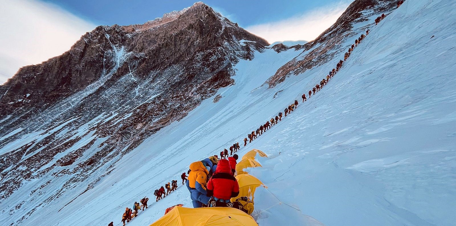
- The summit sits in the death zone above 8,000 meters, where oxygen levels can't sustain human life. Even with bottled oxygen, climbers are slowly dying from altitude exposure.
- Edmund Hillary and Tenzing Norgay summited first on May 29, 1953. British expedition. Changed mountaineering history forever.
- Over 300 people have died on Everest since climbing attempts began. Most bodies remain on the mountain. Recovery at extreme altitude is nearly impossible.
- Kami Rita Sherpa holds the summit record with 30 successful climbs as of 2024. Sherpa communities from Nepal's Khumbu region dominate high-altitude mountaineering through both cultural tradition and physiological adaptation.
- Summit temperature averages minus 36 degrees Celsius in winter and minus 19 degrees Celsius in summer. Wind chill pushes effective temperatures much lower. Jet streams blast across the peak with winds exceeding 200 kilometers per hour.
- Two main climbing routes exist. The South Col route from Nepal sees more traffic. The Northeast Ridge from Tibet is technically harder but less crowded. Both carry extreme risks.
- Commercial expeditions cost $30,000 to over $100,000 per person, depending on the services provided. Climbing Everest requires serious money, plus months of training, plus a willingness to accept significant death risk.
- The mountain generates its own weather systems. Sudden storms kill climbers even during the supposedly safer climbing seasons of April-May and September-October.
- Marine fossils appear near the summit. In the past, the Ancient seafloor became the world's highest point. It happened through continental collision and tectonic forces operating over fifty million years.
What 8,848.86 Meters Actually Means
The official height of Mount Everest, 8,848.86 meters, is more than just a number. It represents the highest point on Earth, a natural landmark that captures human fascination and the imagination of explorers, scientists, and trekkers alike.
The Highest Point on Earth
The number itself matters less than what it represents. Everest stands as Earth's highest terrestrial point. You cannot get higher without leaving the surface entirely. That simple fact captivates people regardless of whether the precise measurement is 8,848 or 8,849 meters.
Economic Importance for Nepal
For Nepal, the mountain brings massive tourism revenue.
- Climbing permits.
- Trekking fees.
- Porter wages.
- Guide services.
The entire Khumbu region economy revolves around Everest. Sherpa communities have transformed from subsistence agriculture and trade to high-altitude mountaineering and tourism services over the past seventy years.
Symbolic Importance for Tibet and China
Everest represents the northern border of the Tibetan cultural territory. Chinese mountaineers frequently attempt the mountain from the north side, and successful climbs are celebrated as national achievements.

Global Mountaineering Significance
For mountaineers worldwide, Everest represents the ultimate challenge despite not being the most technically difficult peak. Standing on the summit means occupying Earth's highest point, however briefly. That psychological satisfaction drives people to spend enormous sums and accept significant risks.
Geological Laboratory
For geologists, Everest provides a natural laboratory for studying tectonic processes. The mountain embodies fifty million years of continental collision compressed into one dramatic peak. Marine limestone at the summit proves beyond doubt that India's northward drift pushed ancient seafloor to impossible heights.
The Height Tomorrow
Mount Everest measures 8,848.86 meters today, but its height is not fixed. Geological processes, tectonic uplift, and occasional earthquakes mean the mountain continues to change over time. Improved satellite technology may also refine measurements in the coming years.
Continual Growth
Mount Everest measures 8,848.86 meters today. Tomorrow, it'll be fractionally taller from continued tectonic uplift. Next decade, improved satellite technology might refine the measurement further. The next major earthquake might shift it centimeters in unpredictable directions.
The number will keep changing. Slowly through geological processes. Suddenly, during seismic events. And periodically, as measurement technology improves and surveyors recalculate.
But the mountain itself remains. Jet streams blast across the summit. Ice and snow accumulate and then sublimate in the thin air. Climbers attempt the ascent. Some succeed. Some die trying. Tectonic plates keep pushing. Four millimeters per year. Inexorable.
What the Height Really Means
The number 8,848.86 meters is less about precision and more about what Everest represents:
- The highest point on Earth
- Where human ambition meets geological forces
- Where the ancient ocean floor became a sky-high summit
The mountain endures, still deadly, still growing, and still captivating climbers, geologists, and adventurers alike.
Visiting Everest
If you plan to trek near Everest:
- Pack warm clothes for high altitudes
- Book flights early
- Hire local guides and support Sherpa-owned businesses
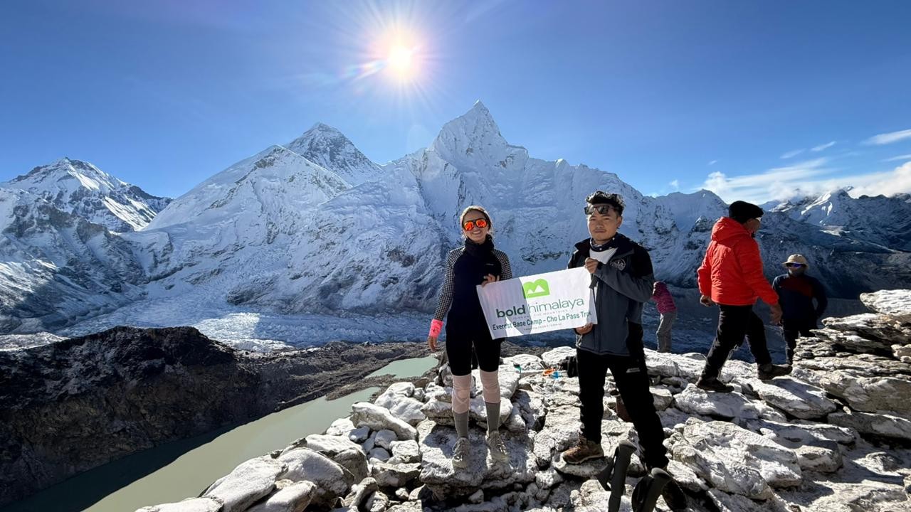
- Take a moment to admire the summit from viewpoints like Kala Patthar or Gokyo Ri—that’s 8,848.86 meters of Earth pushed skyward over millions of years.
When trekking near Mount Everest, consider the Everest Base Camp Trek or the Everest Three Pass Trek for a full Himalayan experience
Different Measurements of Mount Everest’s Height
Over the past 170 years, Mount Everest’s height has been measured many times using different methods—from early trigonometric calculations to GPS and satellite radar. Each survey produced slightly different results depending on whether it measured snow height or rock height, and which country conducted it.
| Year | Reported Height (meters) | Source / Country | Notes |
|---|---|---|---|
| 1856 | 8,840 m | Early calculation of Mount Everest's height by the Great Trigonometrical Survey of India | The first official measurement; impressively close to modern results. |
| 1954 | 8,848 m | Survey of India | Became the standard figure for decades; measured to the rock summit. |
| 1975 | 8,848.13 m | China | Very close to India’s measurement; later used on Chinese maps. |
| 1992 | 8,848.82 m | Italian / European Survey | Used satellite and laser technology for improved accuracy. |
| 1999 | 8,850 m | National Geographic / U.S. GPS Expedition | Included snow layer; popularized in Western media. |
| 2005 | 8,844.43 m | China | Measured only to the rock surface, excluding snow. |
| 2019 | 8,848.86 m | Nepal Survey Department | Conducted with GPS and radar after the 2015 earthquake. |
| 2020 | 8,848.86 m | Joint Nepal-China survey confirms Mount Everest's official height of 8,848.86 meters | The current official height is recognized globally. |
Today, Mount Everest's height is officially 8,848.86 meters, marking it as the highest mountain in the world. The number represents not just a measurement, but human ambition, geological forces, and centuries of study.
Comments (0)
Write a comment- The Mountain That Changes Height
- Names Across Cultures
- How Everest Formed
- Why Mount Everest’s Height Has Been Controversial
- Different Measurements
- Rock vs. Snow Debate
- How British Surveyors First Measured It
- The Great Trigonometrical Survey of India
- How They Measured It
- Naming Controversy
- The 1954 Measurement That Became Standard
- When GPS Complicated Everything
- Snow vs. Rock Debate Resurfaces
- The 1999 National Geographic Measurement (8,850 Meters)
- China’s 2005 Survey and the Split
- The 2015 Earthquake That Sparked New Surveys
- Did Everest Change Height?
- The Need for a Modern Survey
- Nepal’s 2019 Summit Expedition
- China’s Parallel Survey
- Technical Details
- The 2020 Agreement That Ended the Dispute
- Explaining the 86-Centimeter Difference
- Does Everest Actually Keep Growing?
- Tectonic Uplift
- Earthquake Impacts
- Erosion vs. Growth
- Why Everest Is the Tallest Peak
- Some Facts Worth Knowing
- What 8,848.86 Meters Actually Means
- The Highest Point on Earth
- Economic Importance for Nepal
- Symbolic Importance for Tibet and China
- Global Mountaineering Significance
- Geological Laboratory
- The Height Tomorrow
- Continual Growth
- What the Height Really Means
- Visiting Everest
- Different Measurements of Mount Everest’s Height
Read the latest Blogs & Insights
Explore our collection of articles and insights to gain in-depth travel knowledge, expert advice, and stay updated on the latest trends and tips.


No comments yet.