


Ghorepani Tatopani Jomsom Muktinath Trek


5(49)


Ghorepani Tatopani Jomsom Muktinath Trek Itinerary
Your Journey, Step by Step
Day 1: Arrival at Kathmandu
1,400m/4,600ft
Hotel
Upon arrival at the international airport, a representative from Bold Himalaya will be waiting for you. Then you will be transferred to your hotel and helped to settle into your room. You can have rest or explore the vibrant city of Kathmandu.
In the evening, you meet your trekking guide, have a briefing about your trek, and they will help with preparation. Overnight in Kathmandu.
Day 2: Drive to Pokhara
822 m/ 2,697ft
Hotel
Breakfast
6-7 hours
Early morning, after having breakfast in your hotel, your guide will pick you up and start a scenic drive to Pokhara. You’ll pass several villages with beautiful scenery of landscapes and waterfalls along the Trishuli River. And after around 7 hours’ drive, we reach the beautiful city of Pokhara.
Pokhara is a famous tourist destination, and every year thousands of tourists visit Pokhara. There are many places you can visit, like Fewa Tal, Begnas Tal, Mahendra Gufa(cave), and similarly other caves and temples. In the evening, you can walk around the lakeside, which is very beautiful and refreshing. Overnight at Pokhara.
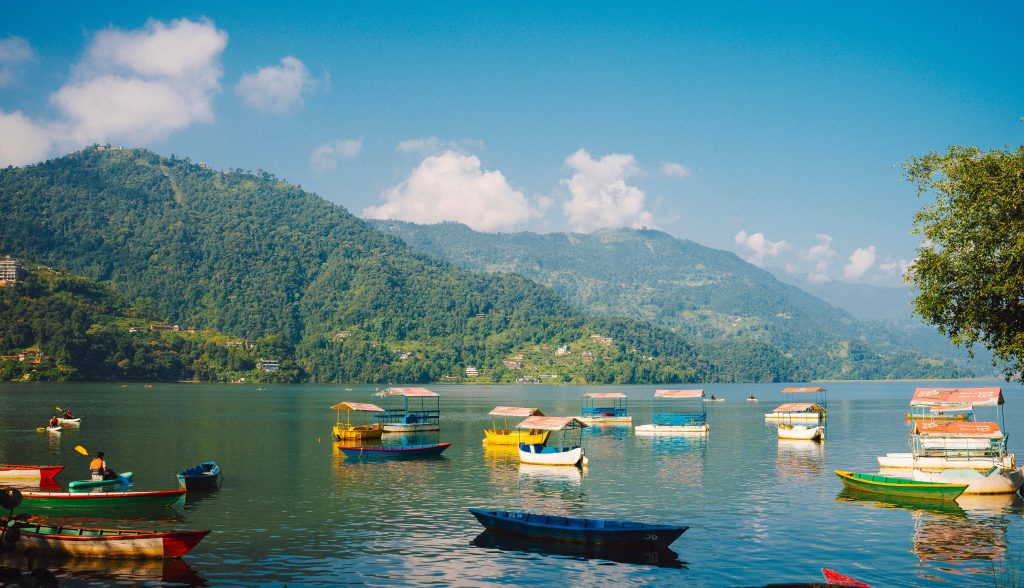
Phewa Lake
Phewa Lake is the second-largest lake in Nepal and the heart of Pokhara’s natural beauty. Surrounded by lush ... Read More
Day 3: Drive to Nayapul and trek to Tikhedhunga
1,540m/5,052ft
Teahouse
Breakfast, Lunch & Dinner
4-5 hours
After a beautiful night in Pokhara, today you are driving to the starting point of our trek to Nayapul, which takes around 1.5-2 hours of driving. Passing several beautiful villages like Hemja, Naudanda, Lumle, with the majestic views of the Annapurna range, we reach Nayapul. Nayapul is a beautiful village situated near the Modi Khola in the northwest of Pokhara. From Nayapul, you will head toward Tikhedhunga.
Following the uphill trail through the fertile farms of rice, maize and millet fields we reach the Birethati. It is located at the junction of Bhurungdi and Modi Khola. Then, passing by a small waterfall and continuing the trail, keeping the river to your left side, we reach Tikhedhunga. Overnight at Tikhedhunga.
Day 4: Tikhedhunga to Ghorepani
2,874m/9,429ft
Teahouse
Breakfast, Lunch & Dinner
5-6 hours
Have a delicious breakfast in Tikhedhunga, and you start your trek to Ulleri. Crossing the suspension bridge near the campsite at Tikhedhunga, you trek through a steep stairway with exactly 3,767 steps. Ulleri is a beautiful, large Magar village. The trail then leads us up the ridgeline through cultivated fields.
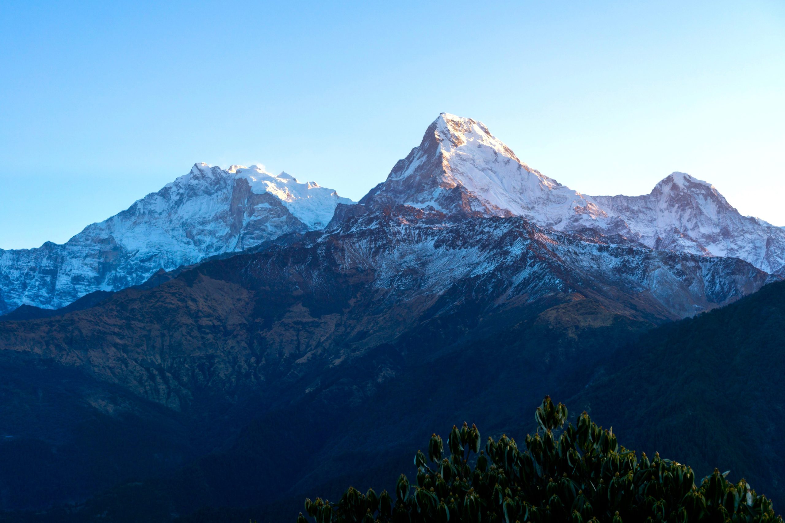
The trail continues through a scenic area of blooming rhododendron flowers and old oak forests, and you’ll keep climbing uphill and reach Nangathanti. And after some rest, continues an hour ascent through the Gurung hill to Ghorepani. Ghorepani presents the majestic views of Mt. Annapurna and Dhaulagiri. Overnight stay in Ghorepani.
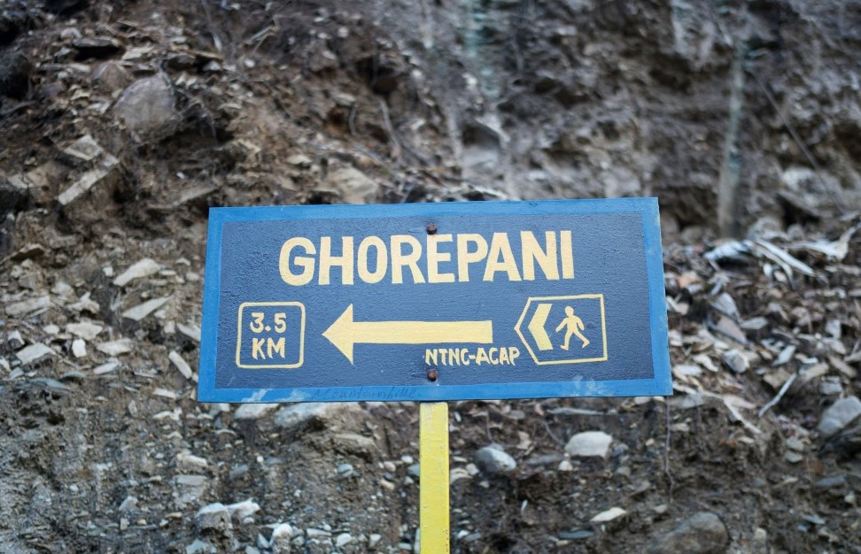
Ghorepani village
Ghorepani is a picturesque mountain village situated at an altitude of 2,874 meters (9,429 ft) in the Myagdi ... Read More
Day 5: Ghorepani to Poon Hill & Tatopani
1,190m/3,904ft
Teahouse
Breakfast Lunch & Dinner
6-7 hours
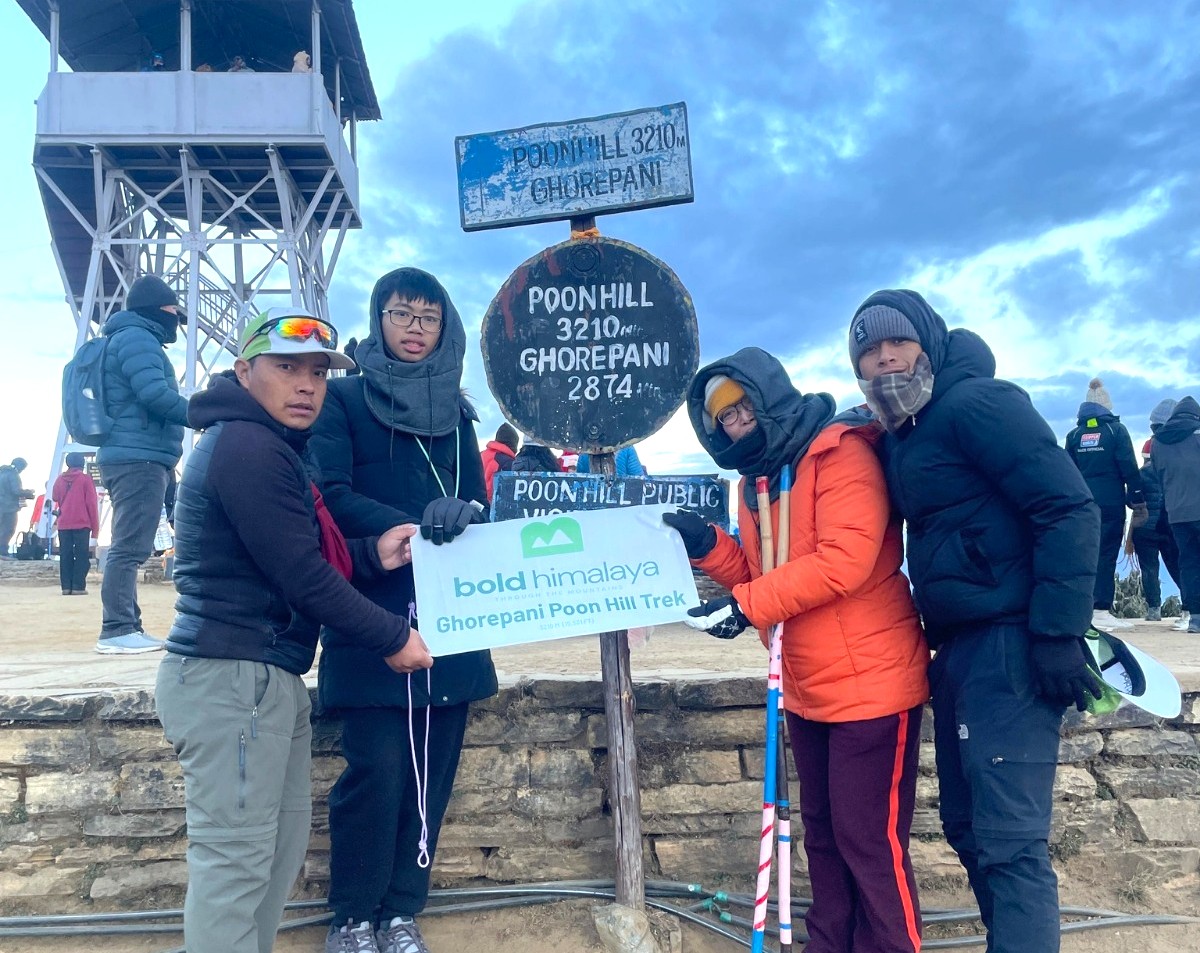
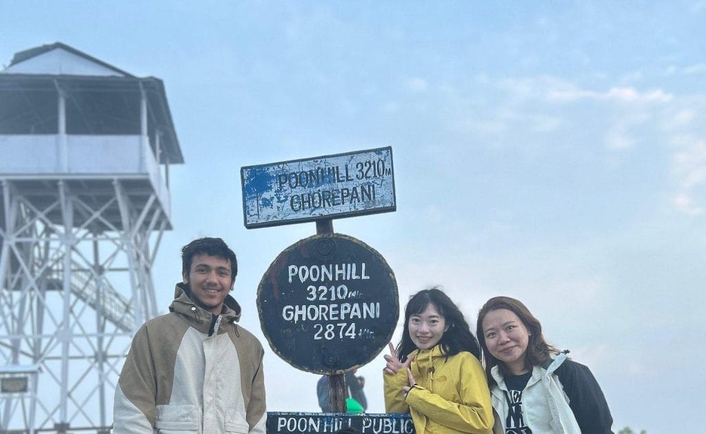
In the early morning, you’ll trek to Poonhill, which takes around 45 minutes to ascend through the rhododendron forest. We reach the majestic viewpoint, Poonhill (3,210m/10,531ft). Poonhill is a grassy top of the hill from where we have unobstructed panoramic views of the huge Himalayas stretching from far western Dolpo and Dhaulagiri.
You’ll enjoy the sunrise over the Annapurna range, Machhapuchhre, Lamjung Himal, Tukuche peak, Nilgiri, Varaha Shikhar, and other snowcapped mountain peaks. After having a wonderful panorama from the majestic viewpoint, we hiked back to Ghorepani.
After a delicious breakfast in Ghorepani, you continue your trek to Tatopani. Crossing numerous ridges through dense pine and rhododendron forest with a rich birdlife. And the little flat section with amazing views of the snowcapped peaks and passing waterfalls to the small village of Tatopani. Tatopani is a beautiful village alongside the river with a natural hot spring, so you can have a relaxing bath in the hot spring. Overnight at Tatopani.
Day 6: Tatopani to Ghasa
2,000m/6,562ft
Teahouse
Breakfast, Lunch & Dinner
6-7 hours
It’s another wonderful trek that passes through the deepest gorge in the world. The trail from Tatopani gradually ascends with the Kali Gandaki River, the deepest gorge. You cross a suspension bridge over the Kaligandaki and continue your walk. Then you’ll pass through the beautiful waterfall, Rupsa Chhahara, and further walking, you reach the beautiful village of Ghasa.
Now, the trail enters the Mustang district and gapes at the lush, verdant landscapes filled with the sound of insects and birds. Ghasa, the last town in Mustang, is the first Thakali village on the road north and the southernmost limit of Tibetan Buddhism in the valley. So the area is culturally different. Ghasa is also a popular place for bird-watching admirers. Overnight at Ghasa.
Day 7: Ghasa to Tukuche
2,590m/8,497ft
Teahouse
Breakfast, Lunch & Dinner
6-7 hours
Today’s trek continues along the road passing the pine trees, tropical forest up to Lete and Kalopani village. You’ll continue following the Kali Gandaki north, where we get to see beautiful apple gardens and the panoramic views of Dhaulagiri, Tukuche, Nilgiri, Fang, the giant icefall, and Annapurna I mountains.
Entering into a deep, windy, dry area, you passed several villages like Larjung village, Kobang village, and finally reached Tukuche village. Larjung is the viewpoint for Dhaulagiri glacier, Tukuche peak, Dhaulagiri I, and many others. Tukuche village is located in the Kaligandaki Gorge and is the centre of the Thakali people. Overnight at Tukuche.
Day 8: Tukuche to Kagbeni
2,804m/9,199ft
Hotel
Breakfast, Lunch & Dinner
5-6 hours
After breakfast in Tukuche, you’ll continue your trek to Kagbeni. The trail from Tukuche continues up the Kaligandaki along the rocky trail and some bushes. After passing the gorge, the terrain becomes more barren, and the breeze increases. On the way, we cross the typical village of Marpha. Marpha has the best apples in Nepal. Next, we reach Jomsom, a large, bustling settlement and administrative center of the region with a small airport, army camp, and many more.
After Jomsom, you trek through a very beautiful route, with an easy, flat walk along the bank of the Kali Gandaki. Enjoying the amazing views of Dhaulagiri, Nilgiri, and Tukuche peak, we reach Kagbeni. Kagbeni is a small village inhabited mainly by Gurungs. Stay an overnight at Kagbeni.

Kagbeni (2,804 m) – Gateway to Upper Mustang
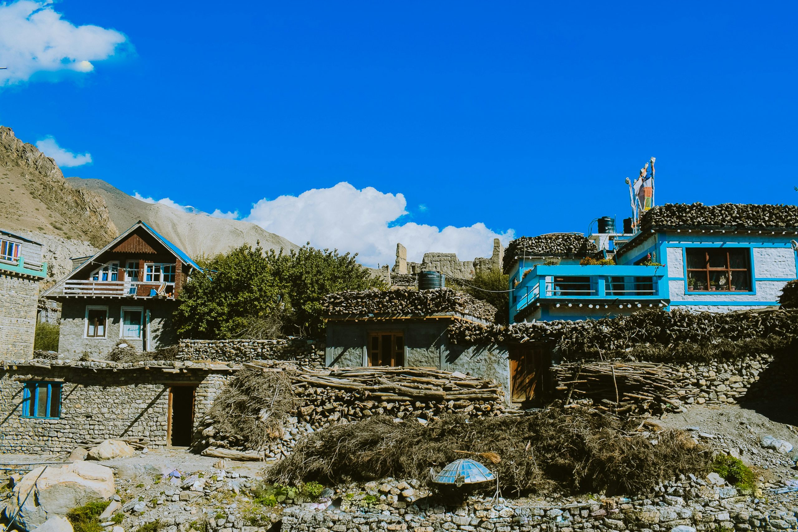
Kagbeni is a 500-year-old medieval village situated at 2,804 meters and serves as the official entry point to ... Read More
Day 9: Kagbeni to Muktinath
3,800m/12,467ft
Teahouse
Breakfast, Lunch & Dinner
4-5 hours
Today, you are hiking to the village of dreams and arrive at the mighty Muktinath. Following the upper Kali Gandaki Valley, the trail gradually ascends through the traditional Mustang villages of Khingar and Jharkot, offering spectacular views of Nilgiri, Dhaulagiri, and the surrounding Himalayan landscape. As you gain altitude, the scenery transforms into the arid, wind-sculpted terrain characteristic of the Mustang region.
After approximately 4-5 hours of trekking, you will reach Muktinath, one of Nepal’s most revered pilgrimage destinations for both Hindus and Buddhists. Stay overnight in the teahouse in Muktinath.
Day 10: Muktinath to Jomsom
2,743m/8,998ft
Teahouse
Breakfast, Lunch & Dinner
5-6 hours
Early in the morning, you’ll hike to Muktinath Temple and explore Muktinath Temple. It is one of the highest temples in the world and holds great significance for all spiritual people on the South Asian sub-continent. There are 108 waterspouts in the backyard of the temple called Muktidhara, and taking a bath in these 108 waterspouts and two ponds is believed to bring salvation. After a spiritual visit to Muktinath Temple, you trek down to Jomsom.
We first climb to Lubra Danda and walk down to the Lubra village. This is one of the most picturesque Thakali villages in this region. With the overwhelming stunning views of the Dhaulagiri, Nilgiri, Tukuche, and other surrounding snow-capped peaks continue along the wide and flat trail. And we reach the district headquarters of Mustang, Jomsom, passing the windy Kali Gandaki river valley. Overnight at Jomsom.
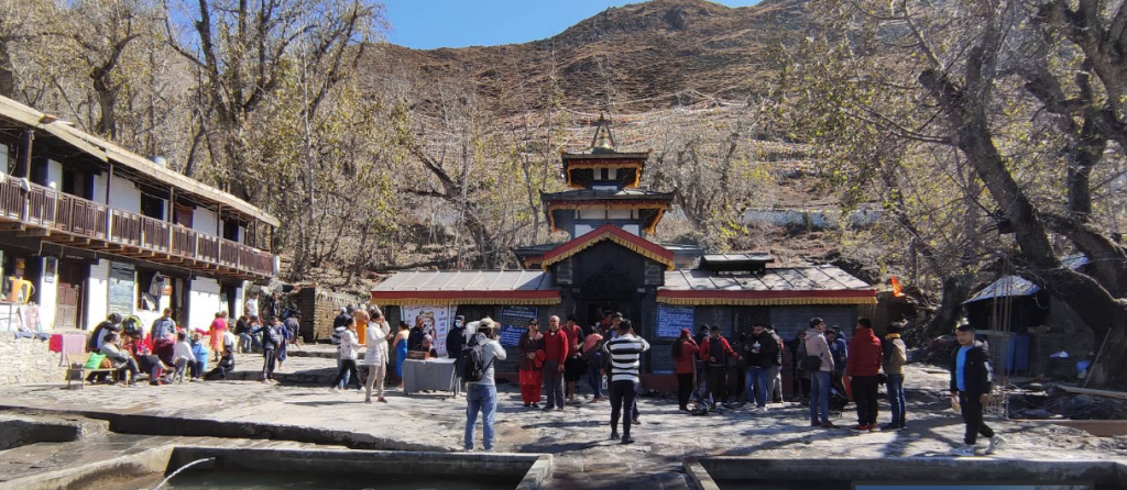
Muktinath – Sacred Pilgrimage at 3,710m
Muktinath is a highly revered pilgrimage site located at 3,710 meters in the Mustang region, at the foot ... Read More
Day 11: Fly to Pokhara
822m/2,697ft
Hotel
Breakfast
25-30 mins
From Jomsom, you will have an incredible morning mountain flight to Pokhara. Enjoying a close-up view of Dhaulagiri and the amazing view of Annapurna I, Annapurna South, Kaligandaki Valley, you land in Pokhara. As the flight from Jomsom to Pokhara is in the morning, you have the whole day to explore beautiful Pokhara.
On reaching Pokhara, you check into a hotel, then you can either find a soothing massage and recover from the tiredness, or explore Pokhara.
Day 12: Drive to Kathmandu
1,400m/4,600ft
Hotel
Breakfast, Lunch & Dinner
6-7 hours
After a delicious breakfast in the hotel, you’ll drive back to Kathmandu. Continuing Prithivi highway with the scenic view of the hillside and with the beautiful river, Trishuli river on the left side to the capital, Kathmandu.
After around seven hours of driving, you reach Kathmandu. On reaching Kathmandu, you will be dropped off at your hotel. In the evening, you will have a cultural dinner with the Bold Himalaya as a farewell dinner. Overnight in Kathmandu.
Note: Alternatively, you can fly from Pokhara to Kathmandu, which is quicker but costs more than traveling by road.
Day 13: Departure or Join New Trip
Breakfast
After a wonderful Ghorepani Tatopani Jomsom Muktinath Trek, today you will be transferred to the international airport three hours before your flight schedule.
Or you can join the new trip.
Want to customize your trip?
We ensure every trip meets your expectations — customize your itinerary anytime to match your travel style and preferences.
Inclusions
What’s Covered in Your Adventure
- Airport Pick up & drop off by private vehicle
- Accommodation in a 3-star category hotel in Kathmandu and in Pokhara
- Accommodation in local tea houses during trek
- All grounded transportation with private shared vehicle
- Jomsom - Pokhara flight
- Three times meals (Breakfast, Lunch, and Dinner) during trekking days with tea/coffee
- English-speaking, and experienced trekking guide with his salary, accommodation, food, equipment, and insurance
- Annapurna Conservation Area Permit and TIMS Card
- First Aid kit box
- All service charges and government taxes
- Lunch and dinner in Kathmandu and in Pokhara
- International Airfare
- Travel insurance
- Tips for guides, porter & driver
- Any kinds of alcoholic or soft drinks
- Personal expenses which is not mentioned in itinerary

Fixed Departure
Fixed Departures, Guaranteed Hassle-Free Travel
Altitude Chart of Ghorepani Tatopani Jomsom Muktinath Trek
Good to Know
Your Journey, Step by Step
Ghorepani Tatopani Jomsom Muktinath Trek Difficulty
The Ghorepani Tatopani Jomsom Muktinath Trek is considered a moderate trek, which makes it suitable for both first-time trekkers with good fitness and experienced hikers. The trail features a mix of steep stone staircases, forest paths, riverside trails, and high-altitude terrain, with daily walks of 5-7 hours. The highest point of the trek is Muktinath (3,800 m), where the thinner air may be noticeable, although the risk of severe altitude sickness is lower than on many higher Himalayan treks.
The most physically demanding sections include the long ascent to Ulleri and the climb to Poon Hill, while the trail from Tatopani to Muktinath involves gradual altitude gain and occasional windy conditions in the Kali Gandaki Valley.
Accommodation on Ghorepani Tatopani Jomsom Muktinath Trek
Accommodation on the Ghorepani Tatopani Jomsom Muktinath Trek ranges from comfortable city hotels to traditional mountain teahouses. In Kathmandu and Pokhara, you will stay in comfortable 3-star to 4-star hotels on a twin-sharing basis. Single rooms can be arranged upon request for an additional cost.
During the trek, accommodation is provided in locally operated teahouses/lodges with twin-sharing rooms. The teahouses are simple, clean, and comfortable, offering an authentic mountain trekking experience. Upgrades or private rooms may be available in some villages, subject to availability.
Meals during this tour
Meals throughout the Ghorepani Tatopani Jomsom Muktinath Trek are freshly prepared at local teahouses and restaurants along the route. The menu offers a variety of Nepali, Tibetan, and continental dishes to suit different tastes and dietary preferences. Popular options include dal bhat, noodles, fried rice, soups, momos, pasta, potatoes, eggs, pancakes, porridge, bread, and seasonal vegetables.
In Kathmandu and Pokhara, you can enjoy a wider selection of cuisines at local restaurants. As you gain altitude, the menu becomes more limited, but the meals remain nutritious and filling, providing the energy needed for daily trekking. Vegetarian options are widely available, and special dietary requirements can usually be accommodated with prior notice.
Altitude Sickness
The Ghorepani Tatopani Jomsom Muktinath Trek reaches a maximum altitude of 3,800 meters (12,467 ft) at Muktinath Temple. While the risk of altitude sickness is lower than on many high-altitude treks, some trekkers may experience mild symptoms as they ascend into the higher elevations of the Annapurna region. Walking at a steady pace, staying hydrated, and following a well-planned itinerary can help your body adapt comfortably.
Symptoms of Altitude Sickness
Common symptoms of mild altitude sickness include:
- Headache
- Dizziness or lightheadedness
- Nausea or vomiting
- Fatigue and weakness
- Loss of appetite
- Difficulty sleeping
- Shortness of breath during exertion
If symptoms become severe or worsen, immediate descent and medical attention are essential.
Physical Preparation
Good physical fitness makes the trek more enjoyable and helps reduce fatigue. Start preparing 6-8 weeks before the trek by focusing on endurance, strength, and cardiovascular fitness.
Recommended activities include:
- Hiking on hills or uneven trails
- Brisk walking or jogging
- Cycling or swimming
- Stair climbing
- Leg and core strength exercises
- Stretching and flexibility training
Aim for 30-60 minutes of exercise, 4-5 days a week.
Facilities during the trek
Electricity: Electricity is available in most teahouses along the route. Charging electronic devices is possible, though a small fee may be charged at higher elevations
ATM & Money Exchange: ATMs are available in Kathmandu, Pokhara, and Jomsom, but may not always be reliable. It is recommended to carry enough Nepalese cash before starting the trek.
Drinking Water: Safe drinking water is available throughout the trek. You can buy bottled or boiled water at teahouses, or refill your bottle using treated water with purification tablets or a filter.
Mobile Network: Mobile coverage is available in many villages through NCELL and Nepal Telecom (NTC). However, the signal may be weak or unavailable in remote sections of the trail.
Wi-Fi & Internet: Many teahouses offer Wi-Fi for an additional charge. Internet speeds may be slow, and connections can become unreliable at higher altitudes.
Hot Shower: Hot showers are available in most teahouses along the route, usually for an extra fee. Availability may vary depending on the location and season.
Charging Facilities: Most teahouses provide charging points for phones, cameras, and other electronic devices. Carrying a power bank is recommended as charging may not always be available.
Permits Required for this trek
To complete the Ghorepani Tatopani Jomsom Muktinath Trek, trekkers need the following permits:
- Annapurna Conservation Area Permit (ACAP)
- TIMS Card (If Applicable)
Documents Required
To obtain the necessary permits, you will generally need:
- A valid passport
- Passport-sized photographs (if required)
- Nepal entry visa
- Permit application details
Your permits will be checked at several checkpoints along the trekking route. Keep them easily accessible throughout the trek to ensure a smooth journey.
Hiring Guide & Porter
Hiring a licensed guide or porter enhances both the safety and enjoyment of the Ghorepani Tatopani Jomsom Muktinath Trek. Guides provide local knowledge, cultural insights, navigation assistance, and support in case of emergencies, while porters help carry your luggage, allowing you to trek more comfortably.
Although experienced trekkers may complete parts of the route independently where permitted, hiring local staff also supports mountain communities and promotes sustainable tourism.
Responsible Tourism
Responsible trekking helps preserve the natural beauty and cultural heritage of the Annapurna region. Follow the Leave No Trace principles by carrying reusable water bottles, disposing of waste properly, respecting local customs and religious sites, staying on designated trails, and minimizing the use of single-use plastics.
Supporting local teahouses, guides, and businesses also contributes to the livelihoods of mountain communities and helps protect the trekking environment for future visitors.
Flora & Fauna
The Ghorepani Tatopani Jomsom Muktinath Trek passes through the diverse ecosystems of the Annapurna Conservation Area, home to a wide variety of plants and wildlife.
Lower elevations are covered with rhododendron, oak, pine, and bamboo forests, while higher areas feature alpine shrubs and dry Mustang vegetation.
Wildlife that may be spotted includes Himalayan monals (Nepal’s national bird), musk deer, Himalayan tahr, langur monkeys, pheasants, and various species of birds and butterflies. Spring is especially beautiful when rhododendron forests bloom with vibrant colors, making the trail even more scenic.
FAQs of Ghorepani Tatopani Jomsom Muktinath Trek
Your Questions, Answered
How many days are required for the trek?
The trek usually takes around 10 to 13 days, depending on your itinerary, walking pace, and side trips.
What is the best time to visit this trek?
The best seasons are spring (March to May) and autumn (September to November). During these months, the weather is stable, and the mountain views are clear.
What is the highest altitude of the trek?
The highest point is Muktinath, located at around 3,800 meters (12,467 feet). Proper acclimatization is recommended to avoid altitude sickness.
Is it possible to return to Kathmandu by flight?
Yes, you can fly from Pokhara to Kathmandu. It is the fastest option but more expensive than traveling by bus or jeep.
Is the trek suitable for solo travelers?
Yes, the route is popular and safe for solo trekkers. However, hiring a guide is recommended for better navigation and cultural insights.
Can beginners do this trek?
Yes, beginners can complete this trek with proper preparation, training, and a steady pace.

Reviews
What Our Travelers Say
Based on 0 ratings
View OurSimilar Packages
Discover our top tours, loved by thousands of travelers annually. Choose the adventure that inspires you and embark on a journey tailored to your desires.
View All Packages