


Where is Mount Everest located?
Everest, the tallest mountain on earth is an emblem of majesty. Thousands of scientists, tourists, and adventurers come here every year because it is famous for its tremendous height and difficult paths.

-
 Sobit Bhandari
-
20 December, 2024
-
1 mins read
-
1526 Views
-
0 Comments
Mount Everest, the tallest mountain on Earth, has captivated explorers, climbers, and adventurers for centuries. It’s 8,848.86 meters (29,031.7 feet) above sea level giant, and Everest isn’t a big mountain—but the ultimate test for one crazy dude who will accomplish it and do something straight outta the wall.
Separated by the Great Himalayan Mountain Range, Everest is a natural border of Nepal and Tibet (Chinese claim). Both possess a secondary designation for the mountain as well: Nepalis call her “Sagarmatha,” or “Sky Goddess,” and Tibetans call her “Chomolungma,” or “World Mother Goddess.”
One of the surprises of Mount Everest is not how high it is, but that it has to lean towards the world. It’s a prayer point where one would pray for the neighbors who live in the houses surrounding it. It’s the mountaineer’s final triumph. It’s a geologist’s marvel for geologists, bigger every year. Though it is the tallest mountain, climbing to the top of this giant is hazardous, yet hundreds of climbers climb to the top in the Everest region every year for the sake of beauty and adventure.
This blog is going to take you by the hand step by step through everything you’re ever going to need to know about where Mount Everest is, what the physical composition of the mountain is, how significant it is culturally, and how to go visit it yourself this incredible natural wonder.
The Significance of Everest's Name
The mountain was also named after British surveyor Sir George Everest, but here’s something that might come as a shock: he himself did not want the mountain to be named after him! The “Sagarmatha” and “Chomolungma” were already in existence used by locals before Westerners entered the region by some decades. That the mountain bears a heroic name is indicative of how strongly rooted the mountain is in regional cultures—not a rock and ice hump, but a goddess or god that guards human inhabitants of her umbra. That there are varied names is an indication of how differently human civilizations see one and the same mountain from their unique cultural perspective.
Mount Everest Quick Facts
| Feature | Details |
| Height/ Elevation | 8,848.86 meters (29,031.7 feet) |
| Location | Border of Nepal and Tibet (China) |
| Exact Coordinates | Latitude: 27.9881° N, Longitude: 86.9250° E |
| Mountain Type | Fold Mountain |
| First Successful Summit | May 29, 1953 (Sir Edmund Hillary and Tenzing Norgay) |
| Nearby Major Cities | Kathmandu, Nepal (approximately 160 km southwest), Lhasa, Tibet (approximately 450 km north) |
| Nearest Airports | Tenzing-Hillary Airport (Lukla), Tribhuvan International Airport (Kathmandu), Lhasa Gonggar Airport (Tibet) |
| Best Time to Visit | Spring (April-May) and Autumn (September-November) |
Geographical Location in Detail
The Himalayas: Home of Everest
Mount Everest stands over the Mahalangur Himal sub-range of the Himalayan mountain system, the majestic mountain system curving for five Asian nations: Nepal, China (Tibet), India, Bhutan, and Pakistan. Envision the Himalayas as a giant wall of mountains 1,500 miles (2,400 kilometers) across from west to east and 125 to 250 miles (200 to 400 kilometers) long from north to south.
The Himalayas feature 10 of the world’s 14 highest mountains above 8,000 meters in height, headed by its own, Everest. They did not seem to have been formed as a geologic oddity but are where, a few centuries or 50 million or even billions of years back, two huge pieces of the Earth’s crust (the world’s Eurasian and Indian tectonic plates) bumped into each other. This is exactly what keeps happening today, and it is how Everest keeps increasing by some 4mm each year—some two pieces of paper thin!
Exact Location: On the Border
Mount Everest technically sits on the Nepal/Tibet border (ruled by China) and the actual summit of Everest is right where their border is.
If you absolutely need to place it on the map, try this:
- Latitude: 27.9881° N
- Longitude: 86.9250° E
It places Everest at the east edge of the Himalaya range, in position celebrated for the unsurpassed view of titanic glaciers, titanic valleys, and thousands of titanic mountains. You might soar over the country and find yourself peering down upon one of the loveliest mountain vistas in the whole world.
Everest in Nepal: The South Side
Its Nepalese face is in Nepal’s Sagarmatha National Park, a world heritage site since it was so designated in 1976 by UNESCO. It covers more than 1,148 square kilometers (443 square miles) of Khumbu territory and is teeming with plant and animal life, given the unfriendly nature of the mountains.
Endangered species of which some include:
- Snow leopards, the “mountain ghosts” or “ghosts” spotted by the thin human eye
- Red pandas, the adorable reddish-brown animals who are not ants
- Himalayan black bears, graze at lower level of forest
- Musk deer, short deer who are renowned for tusks rather than antlers
- Over 118 species of birds who have acclimatized to stay at high altitude
Namche Bazaar, the largest Sherpa town in the area, is an Everest base. Trekkers and climbers pause there to acclimatize and stop before going up higher. Everest’s Nepal side is more ascended by climbers because of the fact that the side of Everest is better developed with trekking paths, better tea houses where one can lodge, and more effective supporting services of Sherpa porters and guides.
Everest in Tibet (China): The North Side
Across it, Tibet is governed by China and here in the region, Everest is protected by the Qomolangma National Nature Reserve. Here, the weather is much more broken-up—tossed around, harsh, and exposed than in the relatively productive valleys you’ve grown accustomed to viewing in Nepal.
The Tibetan side gives a different view of the mountain because, from the Rongbuk Monastery, it is achievable to observe that the north face of the mountain appears colossus-sized. It’s the world’s highest monastery standing at an altitude of 5,009 meters (16,434 feet). Try to envision monks praying and residing at an altitude most of us cannot even survive! The north face of Everest isn’t overly touristy but the bother well worth for so much scenery, good, and culture to absorb.
Peaks and Valleys near Mount Everest
Everest does not have many friends—it has handsome neighbor peaks which collectively constitute an awe-inspiring skyline:
- Lhotse (8,516m) – world’s fourth highest summit, joined with Everest by a ridge called the South Col
- Nuptse (7,861m) – and Everest, giant wall which from multiple routes appears like a single summit
- Changtse (7,543m) – to the north of Everest in Tibet, “Changtse” translates to “north peak” from Tibetan
- Makalu (8,485m) – the fifth highest mountain in the world, seen from Everest and recognizable as a pyramidal-shaped one
These supporting mountains form what looks like an enormous mountain playhouse, with colossal gorges and giant river ice (glaciers) which twist and turn in between. They make one of the best sights you’d ever be lucky enough to see—a rock, ice, and sky fantasy land towering above man next to it.
Ascent of Mount Everest
Nepal (South Route)

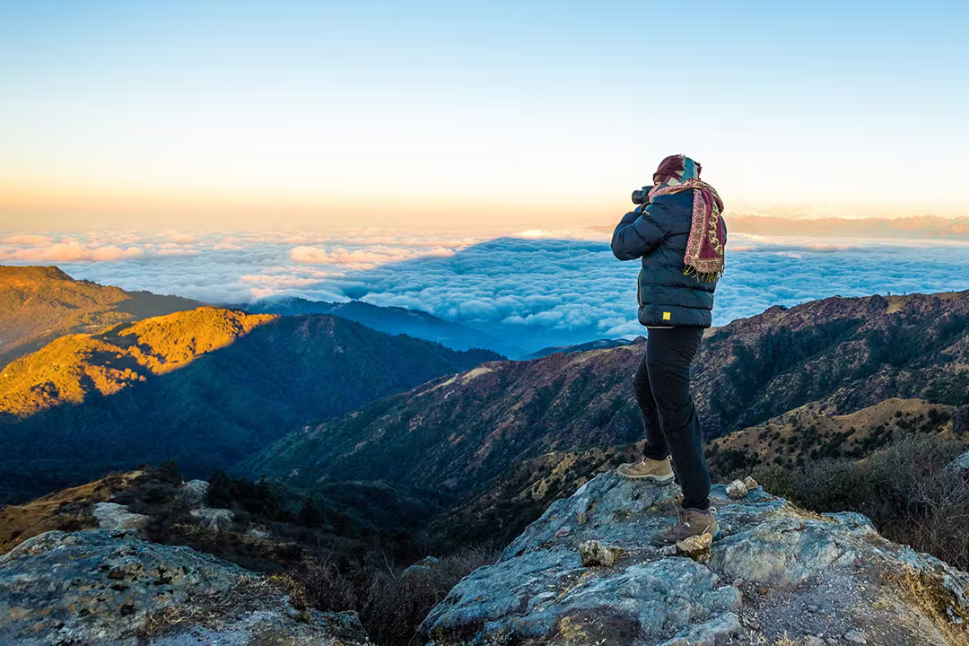
Golden Mount Everest glowing at sunset – a breathtaking Himalayan moment seen from Kalapathar
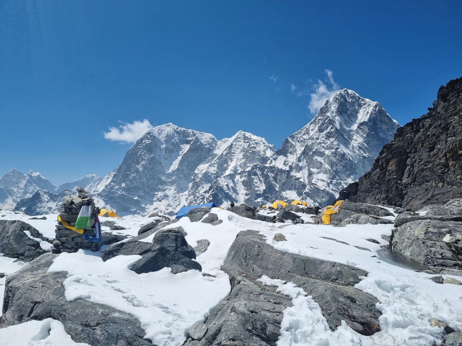
The most popular route to Everest starts in Nepal, and occasionally with heart in mouth on a flight into the legendary (or infamously legendary) Tenzing-Hillary Airport at Lukla. The airport is legendary (or infamously legendary) for being among the world’s most dangerous airstrips—short, downhill, and hang-gliding along the rim of a cliff! The trek then proceeds from Lukla along a rural road up through beautiful Khumbu Valley past a string of Sherpa villages:
- Phakding (2,610m/8,563ft) – A Tranquil village on the Dudh Koshi River where most trekkers will spend their first night
- Namche Bazaar (3,440m/11,286ft) – Fully commercialised town of the region with restaurants, shops, and internet
- Tengboche (3,867m/12,687ft) – Home of giant Buddhist monastery with lovely views of Everest
- Dingboche (4,410m/14,469ft) – Conservation protected valley town and where climbers usually spend an additional day or two acclimatising to high altitude
- Lobuche (4,940m/16,207ft) – Small village with few small lodges on the slope of the Khumbu Glacier
- Gorak Shep (5,164m/16,942ft) – Final camp short of Everest Base Camp, final 1950s base camp
From Gorak Shep, climbers hike up to Everest Base Camp at 5,364 meters (17,598 ft), which experienced climbers ascend from in order to reach the summit. It is an 8-10 day climb so your body will be accustomed to thin air—too much climbing too high too fast and crippling altitude illness follows.
How to get there:
- By Air: 30-minute flight from Kathmandu to Lukla (an experience in itself!)
- By Trekking: From Jiri or Salleri for another-long, easy trek (adds 5-7 days but is nicer and lets you see more of rural Nepal)
From Tibet (North Side)
The trek begins in the capital city of Tibet, Lhasa, with monasteries, palaces, and ancient history. The trekkers leave Lhasa driving across the vast plateau of Tibet, through crumbling monasteries, and over wind-blown mountain passes where prayer flags are frayed.
Compared to one’s side reachable within a three-day trek across Nepalese territories, Tibet-side Everest Base Camp is self-drive accessible and hence more attractive to visitors who do not like trekking so high up to the summit though it has less convenient road access. Tibet-side permits are fewer in number and at the mercy of the government of China. Tibet possesses special permit to enter the country, where one must pass through approved tour operators.
How to reach:
- By Air: From the two principal Chinese cities, Beijing or Chengdu, to Lhasa Gonggar Airport
- By Train: Travel on the Qinghai-Tibet Railway, engineering wonder and world’s highest railway with stunning scenery
- By Road: By off-road drive from Tingri to Lhasa and to Everest Base Camp (700km across the roof of the world)
Physical Characteristics of Mount Everest
Height and Structure
The China-Nepal agreed summit of Mount Everest in 2020, after long decades of conflict, is 8,848.86 meters (29,031.7 feet). That is the ice and snow cap thickness over the summit and sea level to the summit. To put that into perspective better, that’s roughly putting almost ten Empire State Buildings on top of each other!
Everest’s terrain has several important places to be climbed by mountaineers:
- South Col: Level saddle ground at approximately 7,900 meters (25,900 feet) where Camp 4 is situated on the standard Nepal route. Climbers acclimatize on the windy saddle between Everest and Lhotse before climbing to the summit.
- Hillary Step: Near vertical rock face at 8,790 meters (28,840 ft), which was named for Sir Edmund Hillary since he first ascended it. This awe-inspiring test can be re-mapped as the 2015 Nepal earthquake changed it.
- Khumbu Icefall: Extremely hazardous portion of ice to walk between Base Camp and Camp 1 and most hazardous portion of the climb. Try to climb a loose frozen waterfall that is sure to shift or break off at any moment!
- Western Cwm (spelled as “coom”): Enormous, level valley slopes straight downwards to the bottom of Lhotse face. It’s unusually warm at record-high elevation because of the snow on either side of the valley that acts like a reflector umbrella and bounces sun radiance back on itself, and therefore incredibly warm by day.
- Northeast Ridge: Standard Tibet side route, and infamous for being awful concerning the “Three Steps” to have to climb up top.
Mount Everest Glaciers
The mountain is surrounded by huge ice rivers cutting across its surface:
- Khumbu Glacier: The glacier comes down the Nepal side from the Western Cwm and is crossed by climbers ascending the South Col route. It advances 3-4 feet daily, redraping itself and creating new crevasses daily.
- Rongbuk Glacier: Largest on north flank, East and West arms merging into gigantic Y shape. This glacier is near the world’s highest monastery.
- Kangshung Glacier: East side, less ascended but steep and dangerous, the East Face and thus one of most challenging climbs.
Not only are they absolutely stunning, but they also provide life-giving bodies of water to downstream tens of millions of human residents. But oh, they’re being destroyed at a horrific rate too under pressure from global warming, and by some calculations it’s being estimated that they’ve lost more than 25% of their weight in just 40 years alone. They’re creating poisonous glacial lakes, which burst and kill with catastrophic floods.
Geology and Formation
Mount Everest is a fold mountain and was formed through a titanic continental collision. Consider two vehicles traveling towards one another very slowly in slow motion, hoods colliding with each other upwards—essentially how the Himalayas were formed when India collided with Asia. The very same slow process of collision which had been ongoing maybe 50-60 million years ago still goes on today and is constructing the Himalayas.
The mountain consists of:
- Sheared metamorphic rocks and sedimentary rocks of rock deposits
- Fossilized sea creatures over fossilized ancient sea limestone that is millions of years old
- Proof that it has been created in the sea and then pushed upwards by tectonic force
But still another wonderful nugget of Everest trivia is that Everest climbers, literally, walk on rocks originally discovered at the bottom of an ancient sea. Above the top are fossils 450 million years old that indicate that now the top of history’s ancient world was under the sea. Earth’s paleogeology adds so majestic such authentic dynamism to the world and world-scale forces that shaped Earth’s crust millions and millions of years ago.
Vegetation and wildlife around Everest
Despite the extremely high altitude and extreme conditions, the ground around Everest itself is fairly diverse in terms of life, primarily lower down where conditions are less extreme.
Wildlife of the Region
Everest’ home and its surroundings protected places contain some of the most beautiful species in the world, which made this desolate land inhabitable:
- Snow Leopard: Legend of big cat of divine caliber, snow leopards roam vast ranges of mountains, best adapted to roaming in snow. Snow leopards are jewels when out of human proximity, and their count in Nepalese mountains doesn’t even represent 350-590 snow leopards.
- Himalayan Tahr: Native goat subspecies to region that is unexpectedly adept at climbing up vertical landscape. Woolly coverings are placed over them during mountain winter cold months, and one can most often find them grazing on impossibly steep slopes.
- Red Panda: Found in lower wood slopes, the threatened mammal lives almost entirely off of bamboo. Bush-tailed and reddish-brown, cat-sized domestic housecats, and now more and more ever less often as forestland is consumed.
- Musk Deer: Also known for secreting the musk whose males (sadly making them a poacher’s prey) are well known by fame, inhabiting forest below 3,500 meters elevation. They possess tusks instead of antlers.
- Himalayan Monal: Rainbow-colored iridescent national bird of Nepal with iridescent plumage of rainbow colors, occurs in alpine grasslands. Rainbow-colored plumage of the male glistens in sunlight.
- Himalayan Black Bear: Black bears up to 3,800 metres high in forests with a white V-shaped patch on the chest and otherwise black fur.
The trek route to Everest Base Camp has a few of these animals to be found on the route but no small mammals or birds, while the large wild felines like snow leopards are almost impossible to find in the wild.
Plant Life at Altitude
Vegetation becomes more prevalent as you ascend to higher altitudes, but there is vegetation that has learned to survive so that it can weather the brutality of the climate at the given heights:
- Under 4,000m: Nation’s national flower, rhododendron forests, produce lovely white, pink, and red strings of flowers during spring. Fir, juniper, and birch trees provide impenetrable forest cover with rich wildlife too.
- 4,000-5,000m: Dwarf rhododendrons are inches tall but have gorgeous flowers. Alpine flowers like edelweiss, primroses, and gentians exhibit carpet-colored hue in the short summer, heavy herbivores supported by dense grasses.
- Above 5,000m: Primarily mosses and lichens, and a few above 6,000m, some of the world’s highest plants. These humble plants endure intense cold, intense UV, and prolonged dryness.
These plant-covered mountainsides are not just medicinally potent but also environmental adaptations and are used in traditional Sherpa and Tibetan medicine for the treatment of altitude sickness, respiratory disease, and other ailments. Yartsa gunbu (fungal infection of the caterpillar) in such high-altitude grazing land is invaluable for the presumed medicinal use.
Climate and Weather Conditions
The weather of Mount Everest is the most severe in the globe. The weather becomes hazardous or even deadly to climbers and travelers within a few hours.
Seasonal Differences
- Winter (December-February): Extremely cold ranging from -60°C (-76°F) to hurricane gusts of 110 km/h. Nobody goes for climbing then—it would be suicidal.
- Spring (March-May): Most climbers reach Everest at this time. The weather is more predictable, winds are lighter, and temperature at the summit could be as low as -20°C to -35°C (-4°F to -31°F). If climbing Everest is something you want to experience, it’s your turn now.
- Monsoon (June-September): Blowy heavy snow at high altitudes and low-reach heavy snows pounded around by rain. Zero visibility and perpetual avalanche. Monsoon climb very perilous and seldom attempted.
- Autumn (October-November): Secondary climbing season commences with fairly stabilized weather. Cold compared to spring, though, and early winter storms can materialize very quickly.
Extreme Weather Phenomena
Everest is so massive that it creates its own climate:
- The jet stream—a river of incredibly, incredibly high-speed air way up high in the atmosphere—meets Everest head-on during winter, so maximum winds are over 160 km/h.
- Weather can turn from perfect to fatal in a few hours.
- Special lens-like clouds are wont to form over the top. When snow is being blown off the top, people call it the “smoking summit”—the mountain’s supposed to be smoking a cigarette!
The Death Zone
Over 8,000 meters (26,247 feet) lies the infamous “Death Zone” climbers are familiar with:
- Not a scary nickname—a matter of life and death:
- There is about one-third of the oxygen we breathe at sea level.
- Your body starts to shut down and die.
- Most climbers carry oxygen tanks with them, but supplemental oxygen or no supplemental oxygen, you can’t stay.
- The longer you’re in the Death Zone, the quicker you’ll die.
Cultural and Historical Significance
Historical Context
They were familiar with this giant mountain for a while but not that it was the world’s highest until the mid-1800s. Surveying India as part of preparation to execute the Great Trigonometric Survey of India, they temporarily named it “Peak XV.” An Indian mathematician, Radhanath Sikdar, was the one who mathematically verified in 1852 that indeed it was the world’s highest point.
It was officially named by the British in 1856, though previously they had named it in 1865 after Sir George Everest, the man who had overseen surveying India. Ironically enough, however, Everest himself did not want the mountain to be named after him!
It was Edmund Hillary from New Zealand and Sherpa Tenzing Norgay who first stepped onto the peak of Everest on May 29, 1953. It was front-page news every day in the world in every newspaper and inspired people to climb one day.
Historic Expeditions and Records
There have been numerous historic firsts happen on Everest through the years:
- It was 1978 that Reinhold Messner and Peter Habeler accomplished what everyone thought was impossible—their oxygen-tank-free ascent.
- Junko Tabei ascended to the summit on Everest as the first woman mountaineer in 1975.
- Two of the Sherpa climbers, Apa Sherpa and Phurba Tashi Sherpa, possess oxygen-tank-free climbs the most: 21 each!
- Some believe that English climbers George Mallory and Andrew Irvine did reach the summit in 1924, but the two vanished on the mountain and we’ll never be certain.
Religious and Cultural Significance
For residents, Everest isn’t a monolithic rock-and-ice edifice—it’s sacred:
- The Tibetans called it “Chomolungma,” world mother.
- The Nepalis call it “Sagarmatha,” the sky goddess.
- The mountain is revered by Sherpa people. Sherpa people have special pujas before ascending, requesting the mount’s blessing and permission.
There are Buddhist monasteries and prayer flags scattered across the face of Everest. Sherpa people, living in Nepal’s Khumbu region near Everest, also have a culture that is directly linked with the mountain. They’re famous worldwide for having unbelievable climbing skills and knowledge of the terrain.
Climbing Mount Everest
Modern Climbing Statistics
Climbing Everest is more fashionable now but not safer:
- 800-1,000 people attempt to climb Everest each year.
- The success rate has risen astronomically—about 18% in the 1990s to well over 60% today.
- The death rate has fallen to about 1%, but that is still about 1 out of every 100 climbers who die.
- Over 300 people have died climbing Everest since records began, with many bodies remaining on the mountain.
- Most hectic day ever: 354 to attain the summit on May 23, 2019.
Main Routes
Two routes to the top are deemed normal:
- The Southeast Ridge Route (Nepal):
- Employed by Hillary and Tenzing on their initial ascent.
- The more popular route and less technically challenging at times.
- The climbers must climb over the treacherous Khumbu Icefall and Western Cwm.
- Four camps lie above Base Camp.
- The North Ridge Route (Tibet):
- It was George Mallory’s route in the 1920s.
- It’s windier and colder every time.
- Greater technical climbing skill is required for the higher reaches.
- Six camps are usually set up above Base Camp by the expeditions.
The Climbing Process
Climbing Everest is not a race to the summit in a single burst but a gradual step-by-step process:
- Acclimatization: Climbers live for weeks at Everest Base Camp, gradually ascending and descending higher altitudes so that their bodies can get accustomed to thin air.
- Setting Up Camps: Teams progress to establish and man a chain of camps at various altitudes:
- Base Camp: 5,364m (17,598ft) on Nepalese side
- Camp 1: 6,065m (19,900ft)
- Camp 2: 6,500m (21,300ft)
- Camp 3: 7,470m (24,500ft)
- Camp 4: 7,920m (26,000ft)
- Summit Push: Climbers start their advance from Camp 4 when weather seems to be good, generally early morning at midnight to attempt to reach summit by morning.
- Descent: Coming down is generally the most dangerous. Accidents tend to happen during descent because mountaineers are tired and tend to make the wrong decisions.
Digital Connectivity and Everest
Even in one of the most remote areas on the globe, Everest has surprise connectivity now:
- 4G/LTE cell signals extend as far as Everest Base Camp and further in some of the higher camps.
- Climbers tweet and video call frequently from the top.
- The first 3G cell tower was placed at Base Camp in 2010.
- Satellite phones allow teams to receive weather reports and organize emergency response.
Access has completely revolutionized the climb experience and rescue procedure when things don’t go as planned.
Tourism and Economic Impact
Mount Everest is also an important economic force, especially for Nepal:
- Everest climbs bring Nepal’s economy over $300 million a year.
- There are thousands of Nepalis working as guides, porters, cooks, and support staff.
- Tourism has been facilitated by better roads, airports, and communications infrastructure in these remote regions.
- A richness of cultural exchange comes from the mix of foreign visitors and host nationals.
This disastrous tourism dependence, however, ravages when tragedies, politics, or world crises such as COVID-19 turn off the faucet of tourists.
Conservation and Environmental Issues
Heightened popularity of Everest has generated enormous environmental problems:
- Waste disposal: Decades of summits have dumped bags of garbage, empty oxygen cans, and human feces.
- Crowding: Climbers over the past few decades have created “traffic jams” of climbers in unsafe bottlenecks on the mountain, where climbers are lined up in the Death Zone.
- Climate Change: Climatic change is melting the ice and changing weather and altering the mountain and creating new hazards.
Nepal and China have tried to reduce these issues, including legislation requiring climbers to bring back their own garbage, regulations on the number of climbing permits issued, and cleanup missions to take down old climbers’ garbage.
Alternative Ways to experience Everest Without Climbing
Not all bodies can (or want) to climb Everest, but there are many other options to view this magnificent mountain:
Most popular option for non-climbers:
- Takes 12-14 days round trip from Lukla
- Reaches 5,364m (17,598ft) high at Base Camp
- Provides dramatic views of Everest and other peaks
- Is appropriate for relatively fit people with no climbing history
- Lets you experience Sherpa village life along the way
Some people prefer to do this alternative trek with equally good views:
- Comprises stunning turquoise Gokyo Lakes
- Includes climb of Gokyo Ri (5,357m) with view of four of the six highest peaks in the world
- Usually less crowded than the main Everest Base Camp route
- With Everest Base Camp tours through challenging Cho La Pass
For those short on time or physical ability:
- 3-4 hour “Everest Experience” heli flights from Kathmandu
- Helicopter landings on Kala Patthar (5,545m) with view of Everest
- Breakfast possibilities in Everest View Hotel’s high altitude (3,880m)
- Ranges from $1,000-$5,000 depending on what is included
Mount Everest, being not only the highest peak on the planet but also a source of inspiration to humankind, a repository of cultural heritage, and a natural wonder symbol, located on the border of Nepal-Tibet (China), towering above the Himalayas, attracts thousands of visitors every year because of its splendor.
No matter if it is from Nepal's Sagarmatha National Park emerald valleys or Tibet's Qomolangma National Nature Reserve desolate plateaus, Everest's presence alone continues to evoke awe and veneration. Its very position at 27.9881° N, 86.9250° E is not merely a geographic landmark, but a peak of the natural composition of Earth and a point of convergence of different cultures united in worship for this majestic mountain.
The more we come to know and find out about Mount Everest, the more it is important to preserve its natural environment and, along with that, also respect its cultural significance so that upcoming generations can utilize the world's highest point to the fullest.
Comments (0)
Write a comment- The Significance of Everest's Name
- Mount Everest Quick Facts
- Geographical Location in Detail
- Ascent of Mount Everest
- Physical Characteristics of Mount Everest
- Vegetation and wildlife around Everest
- Climate and Weather Conditions
- Cultural and Historical Significance
- Climbing Mount Everest
- Digital Connectivity and Everest
- Tourism and Economic Impact
- Conservation and Environmental Issues
- Alternative Ways to experience Everest Without Climbing
Read the latest Blogs & Insights
Explore our collection of articles and insights to gain in-depth travel knowledge, expert advice, and stay updated on the latest trends and tips.
Adi Kailash Yatra and Trek 2026 Essentials

No comments yet.